alb3801529
Carolingian Empire, 9th Century
| Compartir |
|---|
 Pinterest Pinterest |
 Twitter Twitter |
 Facebook Facebook |
 Copiar enlace Copiar enlace |
 Email Email |
|
Añadir a otro lightbox |
|
Añadir a otro lightbox |


¿Ya tienes cuenta? Iniciar sesión
¿No tienes cuenta? Regístrate
Compra esta imagen.
Selecciona el uso:

Título: Carolingian Empire, 9th Century
Descripción: Ver traducción automática
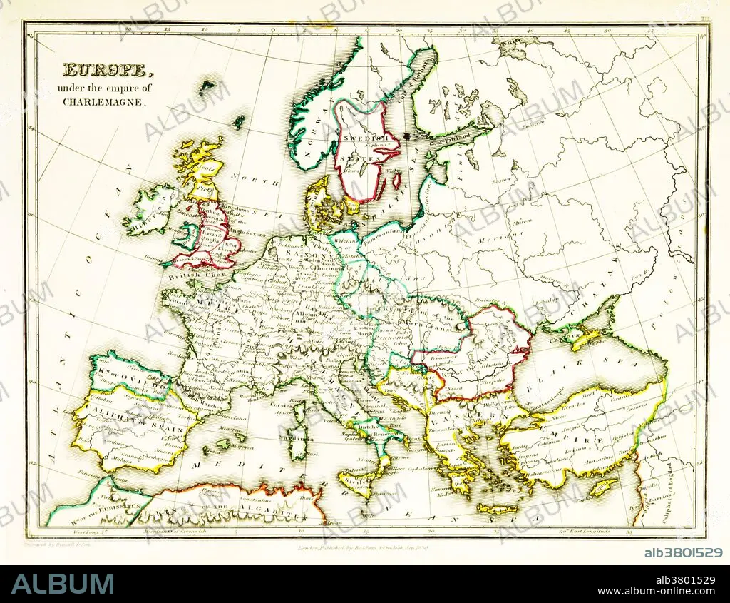
A map of Europe, showing territorial borders existing in the 9th century, under the reign of Charlemagne. Charlemagne (748-814) was the King of the Franks from 768, the King of Italy from 774, and from 800 the first emperor in western Europe since the collapse of the Western Roman Empire three centuries earlier. The expanded Frankish state he founded is called the Carolingian Empire. Map published in 1831.
A map of Europe, showing territorial borders existing in the 9th century, under the reign of Charlemagne. Charlemagne (748-814) was the King of the Franks from 768, the King of Italy from 774, and from 800 the first emperor in western Europe since the collapse of the Western Roman Empire three centuries earlier. The expanded Frankish state he founded is called the Carolingian Empire. Map published in 1831.
Crédito: Album / Science Source / British Library
Autorizaciones: ? Cesión de modelo: No - ? Cesión de propiedad: No
¿Preguntas relacionadas con los derechos?
¿Preguntas relacionadas con los derechos?
Tamaño imagen: 3543 × 2742 px | 27.8 MB
Tamaño impresión: 30.0 × 23.2 cm | 1394.9 × 1079.5 in (300 dpi)
