alb5412020
Kilauea Eruption, May 2018

|
Añadir a otro lightbox |
|
Añadir a otro lightbox |


¿Ya tienes cuenta? Iniciar sesión
¿No tienes cuenta? Regístrate
Compra esta imagen.
Selecciona el uso:

Título:
Kilauea Eruption, May 2018
Descripción:
Ver traducción automática
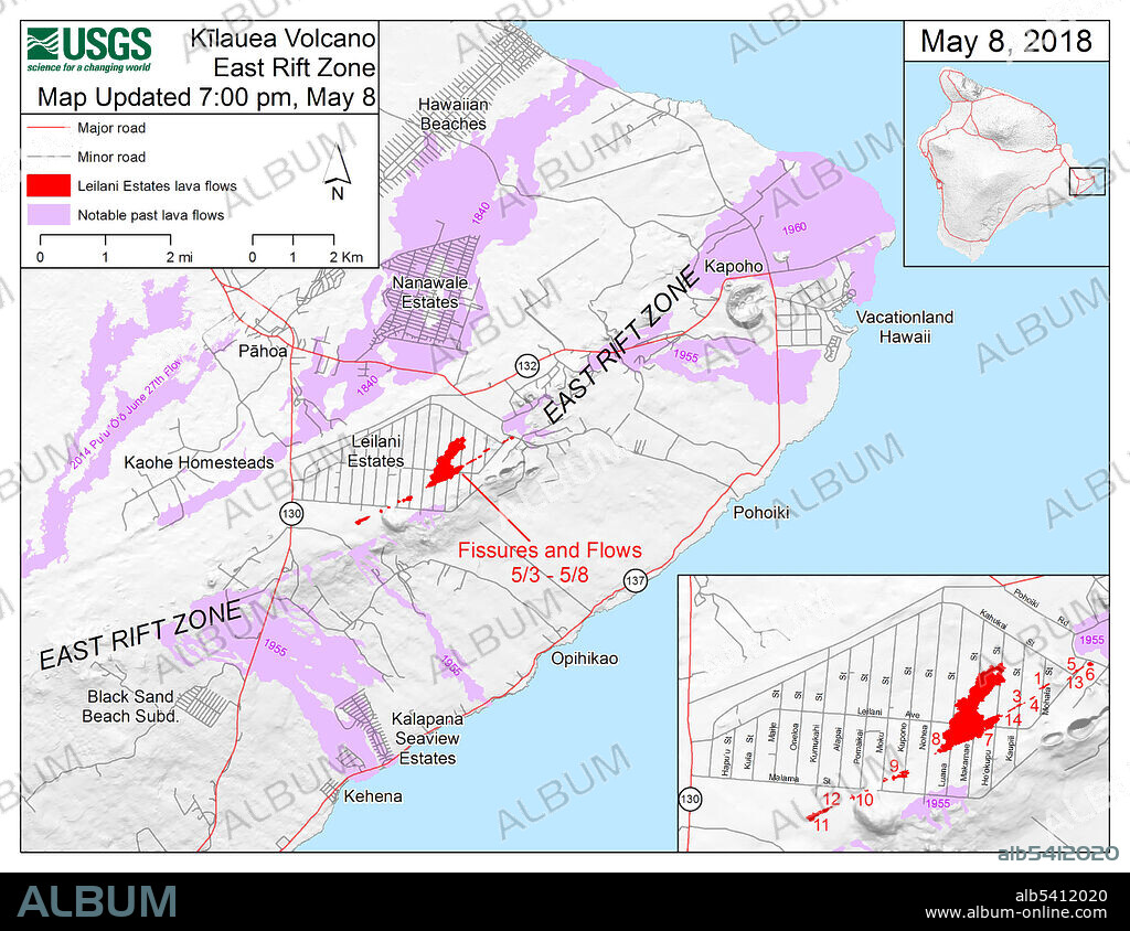
Map showing the fissures and lava flows from Kilauea's lower East Rift Zone eruption, as of 7:00 p.m. HST, May 8, 2018. Shaded purple areas indicate lava flows erupted in 1840, 1955, 1960, and 2014-2015. The 2018 lava flows are in red. Compare with the map from June 25 (SS21449783) to see how the lava flows have expanded and changed the coastline.
Crédito:
Album / Science Source / U.S. Geological Survey
Autorizaciones:
Modelo: No - Propiedad: No
¿Preguntas relacionadas con los derechos?
¿Preguntas relacionadas con los derechos?
Tamaño imagen:
3300 x 2550 px | 24.1 MB
Tamaño impresión:
27.9 x 21.6 cm | 11.0 x 8.5 in (300 dpi)
Palabras clave:
AMERICA • CIENCIA DE LA TIERRA • COMPARAR • DESASTRE NATURAL • DIAGRAMA • ESTADOS UNIDOS DE AMERICA • GEOGRAFIA • GEOLOGIA • HISTORIA • ILUSTRACION • ISLAS DE HAWAI • MAPA • VOLCAN
 Pinterest
 Twitter
 Facebook
 Copiar enlace
 Email
Email
