alb4203989
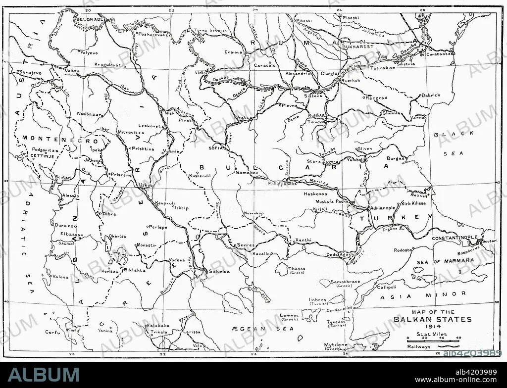
Map of the Balkan States in 1914. From Hutchinson's History of the Nations, published 1915.
| Compartir |
|---|
 Pinterest Pinterest |
 Twitter Twitter |
 Facebook Facebook |
 Copiar enlace Copiar enlace |
 Email Email |
|
Añadir a otro lightbox |
|
Añadir a otro lightbox |


¿Ya tienes cuenta? Iniciar sesión
¿No tienes cuenta? Regístrate
Compra esta imagen.
Selecciona el uso:

Descripción:
Ver traducción automática
Map of the Balkan States in 1914. From Hutchinson's History of the Nations, published 1915.
Crédito:
Album / Universal Images Group / Universal History Archive
Autorizaciones:
Modelo: No - Propiedad: No
¿Preguntas relacionadas con los derechos?
¿Preguntas relacionadas con los derechos?
Tamaño imagen:
4961 x 3543 px | 50.3 MB
Tamaño impresión:
42.0 x 30.0 cm | 16.5 x 11.8 in (300 dpi)
Palabras clave:
1914 • AGUAFUERTE • ARCHIVO • CONFLICTO BELICO • DOCUMENTO • ENGRAVING • FICHERO • GEOGRAFIA • GEOGRAFICO • GRABADO • GRABADOS • GUERRA MUNDIAL I 1914/18 • GUERRA MUNDIAL I • GUERRA • HISTORIA • HISTORICO • ILUSTRACION • MAPA • MUNDO • PAÍS • PAISES • PRIMERA GUERRA MUNDIAL 1914/18 • PRIMERA GUERRA MUNDIAL • PRIMERA • PRIMERO • S. XX • SIGLO XX • SIGLO • UNO • WAR
