alb4529017
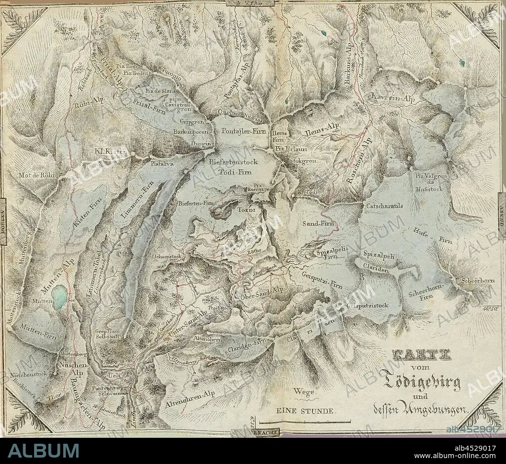
Map of the Tödigebirg and its surroundings, Map of Tödi and surroundings, plate 1, before S. 1, Hegetschweiler, Johannes, 1825, Johannes Hegetschweiler, Reisen in den Gebirgsstock zwischen Glarus und Graubünden in den Jahren 1819, 1820 und 1822. Zürich: Orell, Füssli und Compagnie, 1825.
| Compartir |
|---|
 Pinterest Pinterest |
 Twitter Twitter |
 Facebook Facebook |
 Copiar enlace Copiar enlace |
 Email Email |
|
Añadir a otro lightbox |
|
Añadir a otro lightbox |


¿Ya tienes cuenta? Iniciar sesión
¿No tienes cuenta? Regístrate
Compra esta imagen.
Selecciona el uso:

Descripción:
Ver traducción automática
Map of the Tödigebirg and its surroundings, Map of Tödi and surroundings, plate 1, before S. 1, Hegetschweiler, Johannes, 1825, Johannes Hegetschweiler, Reisen in den Gebirgsstock zwischen Glarus und Graubünden in den Jahren 1819, 1820 und 1822. Zürich: Orell, Füssli und Compagnie, 1825
Crédito:
Album / quintlox
Autorizaciones:
Tamaño imagen:
3641 x 3150 px | 32.8 MB
Tamaño impresión:
30.8 x 26.7 cm | 12.1 x 10.5 in (300 dpi)
