alb9083455
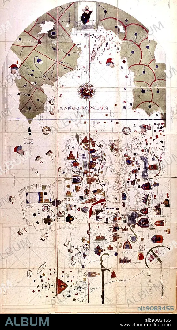
The earliest map showing both Old and New Worlds, drawn in 1500 by Juan de la Cosa, who sailed with Columbus on the second voyage. Unknown lands are coloured the traditional green.
| Compartir |
|---|
 Pinterest Pinterest |
 Twitter Twitter |
 Facebook Facebook |
 Copiar enlace Copiar enlace |
 Email Email |
|
Añadir a otro lightbox |
|
Añadir a otro lightbox |


¿Ya tienes cuenta? Iniciar sesión
¿No tienes cuenta? Regístrate
Compra esta imagen.
Selecciona el uso:

Descripción: Ver traducción automática
The earliest map showing both Old and New Worlds, drawn in 1500 by Juan de la Cosa, who sailed with Columbus on the second voyage. Unknown lands are coloured the traditional green.
The earliest map showing both Old and New Worlds, drawn in 1500 by Juan de la Cosa, who sailed with Columbus on the second voyage. Unknown lands are coloured the traditional green.
Crédito: Album / TopFoto
Autorizaciones: ? Cesión de modelo: No - ? Cesión de propiedad: No
¿Preguntas relacionadas con los derechos?
¿Preguntas relacionadas con los derechos?
Tamaño imagen: 2243 × 3975 px | 25.5 MB
Tamaño impresión: 19.0 × 33.7 cm | 883.1 × 1565.0 in (300 dpi)
Palabras clave: DESCUBRIMIENTO • ESPANA • ESPAÑA • EXPLORACION • GRAN BRETAÑA • PORTUGAL
