alb3279076
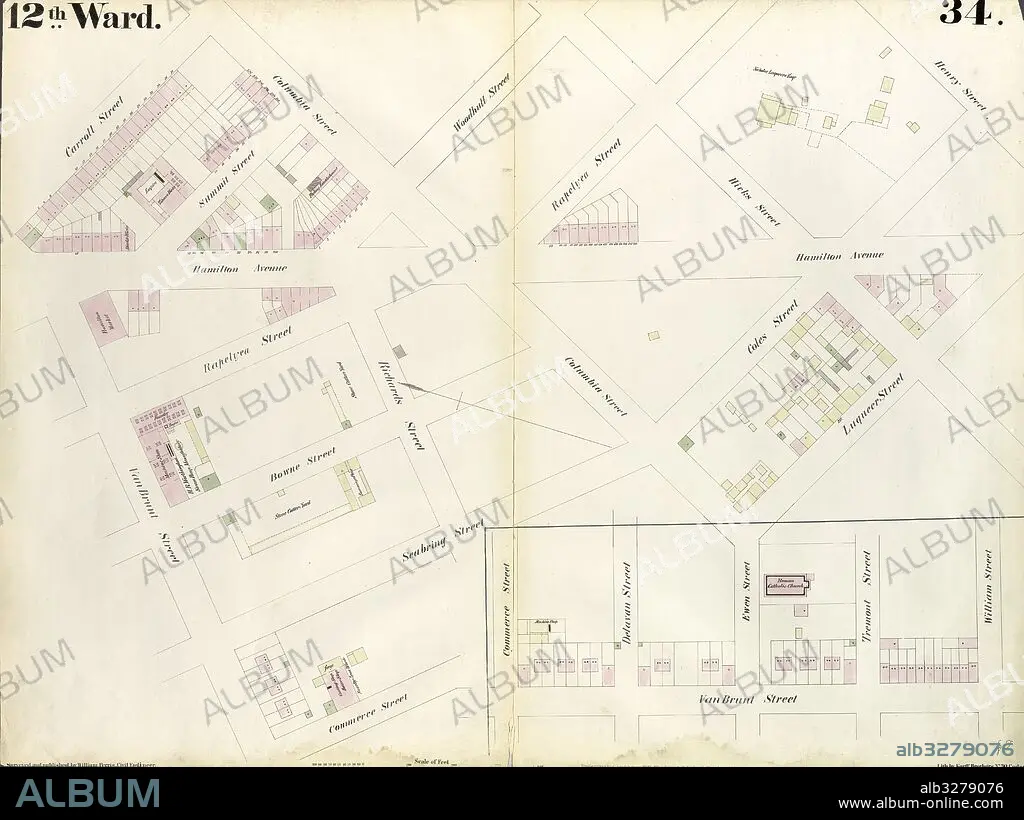
Plate 34: Map bounded by Carroll Street, Columbia Street, Rapelye Street, Henry Street, Luquer Street, Commerce Street, Richards Street, William Street, Van Brunt Street. 1855, William Perris, Brooklyn, New York, N.Y., USA.
| Compartir |
|---|
 Pinterest Pinterest |
 Twitter Twitter |
 Facebook Facebook |
 Copiar enlace Copiar enlace |
 Email Email |
|
Añadir a otro lightbox |
|
Añadir a otro lightbox |


¿Ya tienes cuenta? Iniciar sesión
¿No tienes cuenta? Regístrate
Compra esta imagen

Descripción:
Ver traducción automática
Plate 34: Map bounded by Carroll Street, Columbia Street, Rapelye Street, Henry Street, Luquer Street, Commerce Street, Richards Street, William Street, Van Brunt Street. 1855, William Perris, Brooklyn, New York, N.Y., USA
Crédito:
Album / quintlox
Autorizaciones:
Modelo: No - Propiedad: No
¿Preguntas relacionadas con los derechos?
¿Preguntas relacionadas con los derechos?
Tamaño imagen:
6039 x 4522 px | 78.1 MB
Tamaño impresión:
51.1 x 38.3 cm | 20.1 x 15.1 in (300 dpi)
Palabras clave:
AMERICA • BROOKLYN • CARTOGRAFIA • CARTOGRAFICO • CIUDAD LAS VEGAS • ESTADOS UNIDOS • GEOGRAFIA • MAPA ANTIGUO • MAPA HISTORICO • MAPA • NEOYORQUINA • NEOYORQUINOS • NEW YORK • NUEVA YORK CIUDAD • NUEVA YORK • NY
