alb2602320
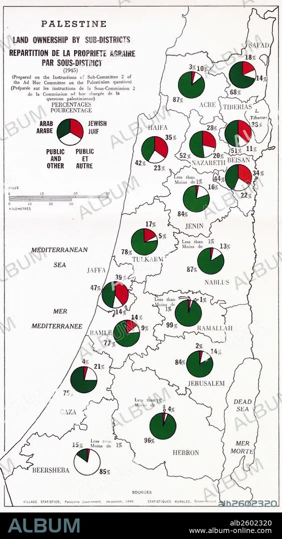
Map showing Palestine Land Ownership by Sub-District.
| Compartir |
|---|
 Pinterest Pinterest |
 Twitter Twitter |
 Facebook Facebook |
 Copiar enlace Copiar enlace |
 Email Email |
|
Añadir a otro lightbox |
|
Añadir a otro lightbox |


¿Ya tienes cuenta? Iniciar sesión
¿No tienes cuenta? Regístrate
Compra esta imagen.
Selecciona el uso:

Título:
Map showing Palestine Land Ownership by Sub-District.
Descripción:
Ver traducción automática
Map showing Palestine land ownership percentages by sub-district. Arab ownership is marked in green and Jewish ownership is makerd in red. Dated 1945.
Crédito:
Album / Universal Images Group / Universal History Archive
Autorizaciones:
Modelo: No - Propiedad: No
¿Preguntas relacionadas con los derechos?
¿Preguntas relacionadas con los derechos?
Tamaño imagen:
2808 x 5100 px | 41.0 MB
Tamaño impresión:
23.8 x 43.2 cm | 9.4 x 17.0 in (300 dpi)
