alb2603576
Map of the historical Duchy of Pomerania.
| Compartir |
|---|
 Pinterest Pinterest |
 Twitter Twitter |
 Facebook Facebook |
 Copiar enlace Copiar enlace |
 Email Email |
|
Añadir a otro lightbox |
|
Añadir a otro lightbox |


¿Ya tienes cuenta? Iniciar sesión
¿No tienes cuenta? Regístrate
Compra esta imagen.
Selecciona el uso:

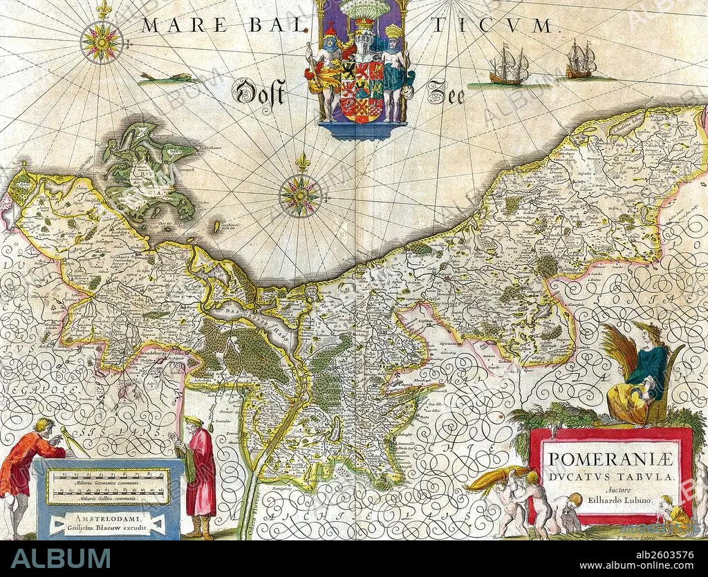
Título: Map of the historical Duchy of Pomerania.
Descripción: Ver traducción automática
Map of the historical Duchy of Pomerania. The Duchy of Pomerania 12th century – 1637 was a duchy in Pomerania on the southern coast of the Baltic Sea, ruled by dukes of the House of Pomerania (Griffins). Dated 1635.
Map of the historical Duchy of Pomerania. The Duchy of Pomerania 12th century – 1637 was a duchy in Pomerania on the southern coast of the Baltic Sea, ruled by dukes of the House of Pomerania (Griffins). Dated 1635.
Crédito: Album / Universal Images Group / Universal History Archive
Autorizaciones: ? Cesión de modelo: No - ? Cesión de propiedad: No
¿Preguntas relacionadas con los derechos?
¿Preguntas relacionadas con los derechos?
Tamaño imagen: 5100 × 3893 px | 56.8 MB
Tamaño impresión: 43.2 × 33.0 cm | 2007.9 × 1532.7 in (300 dpi)
Palabras clave: ALEMANIA • MAPA • MAPAS • POLONIA • SIGLO XVII
