alb2590714
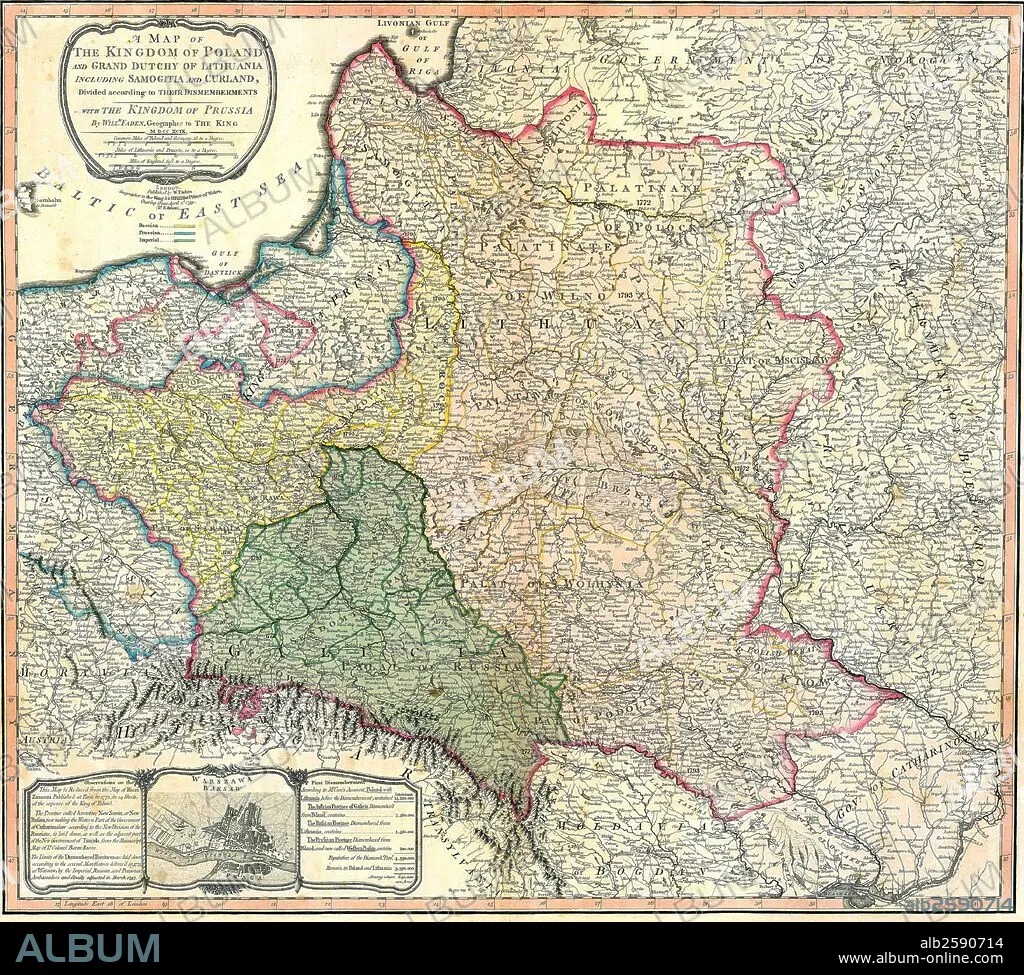
Map of the Partition of the Kingdom of Poland and the Grand Duchy of Lithuania.
| Compartir |
|---|
 Pinterest Pinterest |
 Twitter Twitter |
 Facebook Facebook |
 Copiar enlace Copiar enlace |
 Email Email |
|
Añadir a otro lightbox |
|
Añadir a otro lightbox |


¿Ya tienes cuenta? Iniciar sesión
¿No tienes cuenta? Regístrate
Compra esta imagen.
Selecciona el uso:

Título: Map of the Partition of the Kingdom of Poland and the Grand Duchy of Lithuania.
Descripción: Ver traducción automática
Map of the Partition of the Kingdom of Poland and the Grand Duchy of Lithuania. Dated 1799
Map of the Partition of the Kingdom of Poland and the Grand Duchy of Lithuania. Dated 1799
Crédito: Album / Universal Images Group / Universal History Archive/UIG
Autorizaciones: ? Cesión de modelo: No - ? Cesión de propiedad: No
¿Preguntas relacionadas con los derechos?
¿Preguntas relacionadas con los derechos?
Tamaño imagen: 4827 × 4344 px | 60.0 MB
Tamaño impresión: 40.9 × 36.8 cm | 1900.4 × 1710.2 in (300 dpi)
