alb4088250
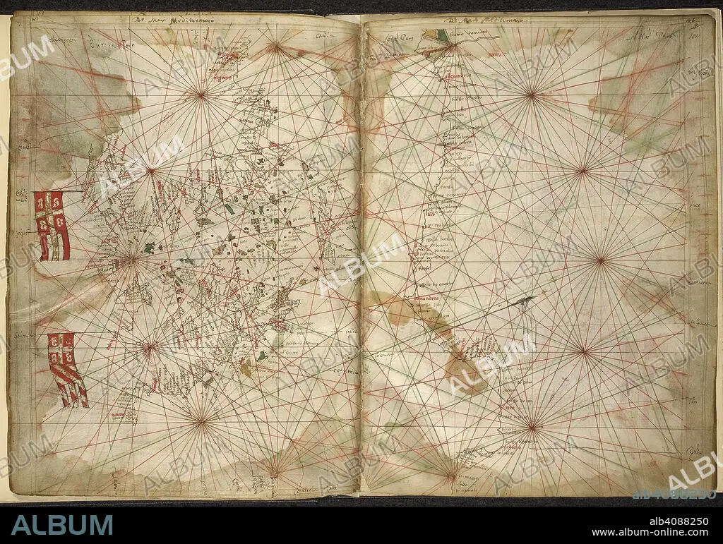
PIETRO VESCONTE. Portolan chart of the Eastern Mediterranean, with Greece, Turkey, the Black Sea, and Crete. Maps of the Liber Secretorum Fidelium Crucis. Italy (Venice); circa 1320-1325. Source: Add. 27376*, ff.183v-184. Language: Latin.
| Compartir |
|---|
 Pinterest Pinterest |
 Twitter Twitter |
 Facebook Facebook |
 Copiar enlace Copiar enlace |
 Email Email |
|
Añadir a otro lightbox |
|
Añadir a otro lightbox |


¿Ya tienes cuenta? Iniciar sesión
¿No tienes cuenta? Regístrate
Compra esta imagen.
Selecciona el uso:

Autor: PIETRO VESCONTE
Descripción: Ver traducción automática
Portolan chart of the Eastern Mediterranean, with Greece, Turkey, the Black Sea, and Crete. Maps of the Liber Secretorum Fidelium Crucis. Italy (Venice); circa 1320-1325. Source: Add. 27376*, ff.183v-184. Language: Latin.
Portolan chart of the Eastern Mediterranean, with Greece, Turkey, the Black Sea, and Crete. Maps of the Liber Secretorum Fidelium Crucis. Italy (Venice); circa 1320-1325. Source: Add. 27376*, ff.183v-184. Language: Latin.
Crédito: Album / British Library
Autorizaciones: ? Cesión de modelo: No - ? Cesión de propiedad: No
¿Preguntas relacionadas con los derechos?
¿Preguntas relacionadas con los derechos?
Tamaño imagen: 6846 × 4798 px | 94.0 MB
Tamaño impresión: 58.0 × 40.6 cm | 2695.3 × 1889.0 in (300 dpi)
Palabras clave: BALCANES • CARTOGRAFIA • CARTOGRAFICO • COLOR • COLORES • COLORIDO • CRETA • DOCUMENTO • EUROPA • GRAFICO • GRECIA • MANUSCRITO • MAPA • MAPAS • MAR MEDITERRANEO • MEDITERRANEO • PIETRO VESCONTE • S. XIV • SIGLO XIV • SUR DE EUROPA • TURQUIA
