alb3833032
Hurricane Sandy Seen from Space
| Compartir |
|---|
 Pinterest Pinterest |
 Twitter Twitter |
 Facebook Facebook |
 Copiar enlace Copiar enlace |
 Email Email |
|
Añadir a otro lightbox |
|
Añadir a otro lightbox |


¿Ya tienes cuenta? Iniciar sesión
¿No tienes cuenta? Regístrate
Compra esta imagen.
Selecciona el uso:

Título:
Hurricane Sandy Seen from Space
Descripción:
Ver traducción automática
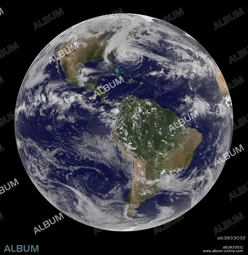
Hurricane Sandy seen from space. Shown are here are how a line of clouds from a continental weather system run south to north along the Appalachian Mountains, approaching from the west to meet the offshore storm. At 2 p.m. EDT, shortly after this image was taken, the U.S. National Hurricane Center reported that Sandy was about 575 miles (930 kilometers) south of New York City. Maximum sustained winds were observed at 75 miles (120 kilometers) per hour, and the barometric pressure at the center of the storm was 951 millibars (28.08 inches). The Geostationary Operational Environmental Satellite 13 (GOES-13) took this image of Hurricane Sandy at 1:45 p.m. EDT on October 28, 2012.
Personas:
Crédito:
Album / Science Source / NASA Earth Observatory/Robert Simmon
Autorizaciones:
Modelo: No - Propiedad: No
¿Preguntas relacionadas con los derechos?
¿Preguntas relacionadas con los derechos?
Tamaño imagen:
3072 x 3004 px | 26.4 MB
Tamaño impresión:
26.0 x 25.4 cm | 10.2 x 10.0 in (300 dpi)
Palabras clave:
2012 • AMÉRICA DEL NORTE • AMERICA SEPTENTRIONAL • CIENCIA • CLIMA • DESASTRE NATURAL • ESPACIAL • ESPACIALES • ESPACIO • ESPIRAL • GOES • HURACAN • METEOROLOGÍA • METEOROLÓGICO • METEREOLOGIA • METEREOLÓGICOS • MUNDO • NORTEAMERICA • NUBARRON • NUBE • NUBES • OJO • OJOS • PLANETA TIERRA • PLANETA • PREVISION • TEMPESTAD • TEMPORAL • TEMPORALES • TIEMPO: TEMPESTAD • TIEMPO: TORMENTA • TIERRA (TERRENO) • TORMENTA • VENTOSO
