alb1657672
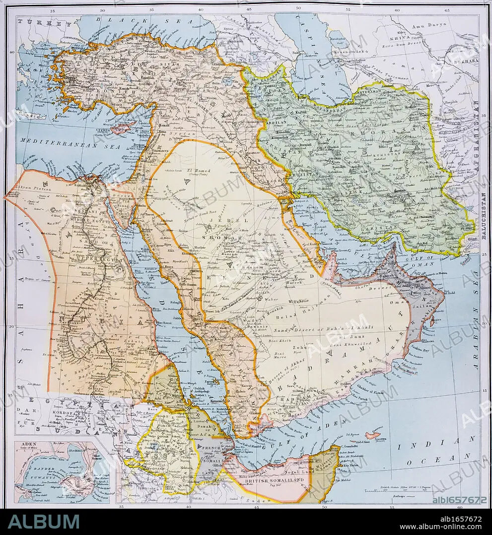
Map of Turkey Middle East Horn of Africa and Persian Gulf in 1890s From The Citizen's Atlas of the World published London circa 1899.
| Compartir |
|---|
 Pinterest Pinterest |
 Twitter Twitter |
 Facebook Facebook |
 Copiar enlace Copiar enlace |
 Email Email |
|
Añadir a otro lightbox |
|
Añadir a otro lightbox |


¿Ya tienes cuenta? Iniciar sesión
¿No tienes cuenta? Regístrate
Compra esta imagen

Descripción:
Ver traducción automática
Map of Turkey Middle East Horn of Africa and Persian Gulf in 1890s From The Citizen's Atlas of the World published London circa 1899
Crédito:
Album / Universal History Archive/Universal Images Group
Autorizaciones:
Modelo: No - Propiedad: No
¿Preguntas relacionadas con los derechos?
¿Preguntas relacionadas con los derechos?
Tamaño imagen:
4341 x 4485 px | 55.7 MB
Tamaño impresión:
36.8 x 38.0 cm | 14.5 x 14.9 in (300 dpi)
Palabras clave:
AFRICA • ATLAS • COLOR ROJO • COLOR • EGIPCIA • EGIPCIAS • EGIPCIO • EGIPTO • EN ROJO • FLOTA • GOLFO • IRAK • IRAN • KEN • MAPA • MAR • MARINA • MARINE • MEDIA • MIDDLE • MITOLOGIA: PERSA • OCEANO • ORIENTE • PERSA • PERSAS • PERSIA • ROJA • ROJO (COLOR) • ROJO • SEA • SIGLO XIX • SIGLO • TURQUIA • VERTICAL
