alb3104271
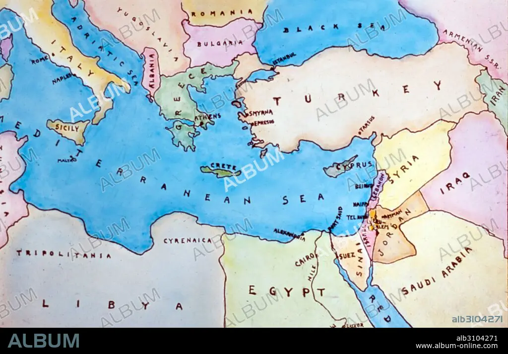
Map of the Eastern Mediterranean and surrounding countries.
| Compartir |
|---|
 Pinterest Pinterest |
 Twitter Twitter |
 Facebook Facebook |
 Copiar enlace Copiar enlace |
 Email Email |
|
Añadir a otro lightbox |
|
Añadir a otro lightbox |


¿Ya tienes cuenta? Iniciar sesión
¿No tienes cuenta? Regístrate
Compra esta imagen.
Selecciona el uso:

Título:
Map of the Eastern Mediterranean and surrounding countries.
Descripción:
Ver traducción automática
Map of the Eastern Mediterranean and surrounding countries. Dated 1977.
Crédito:
Album / Universal Images Group / Universal History Archive \ UIG
Autorizaciones:
Modelo: No - Propiedad: No
¿Preguntas relacionadas con los derechos?
¿Preguntas relacionadas con los derechos?
Tamaño imagen:
5100 x 3299 px | 48.1 MB
Tamaño impresión:
43.2 x 27.9 cm | 17.0 x 11.0 in (300 dpi)
Palabras clave:
AÑOS 70 • AÑOS SETENTA • CARTOGRAFIA • COLOR • COLORIDO • DECADA AÑOS 1970 • FLOTA • MAPA • MAR MEDITERRANEO • MAR • MARINA • MARINE • MEDITERRANEO ORIENTAL • MEDITERRANEO • OCEANO • PAÍS • S. XX • SEA • SIGLO XX
