alb8368726
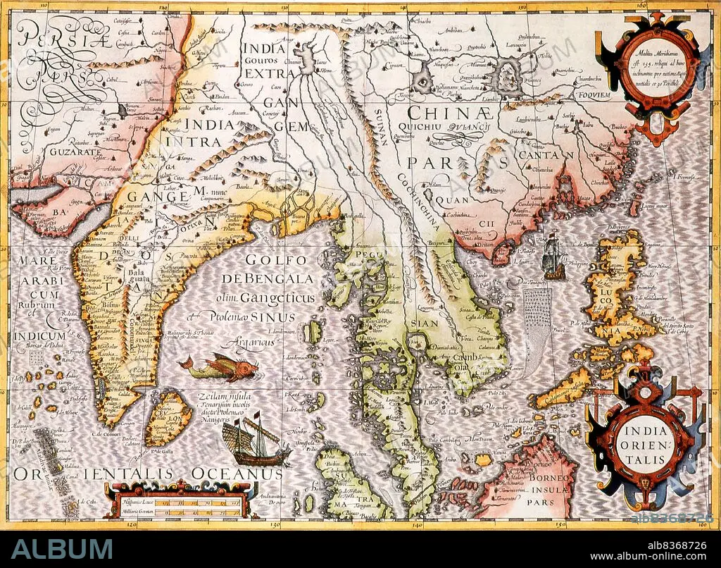
India Orientalis: Early 17th century map of India beyond the Ganges including Southeast Asia and part of China. Published by Jodocus Hondius (Amsterdam, c. 1606) from an original by Gerard Mercator
| Compartir |
|---|
 Pinterest Pinterest |
 Twitter Twitter |
 Facebook Facebook |
 Copiar enlace Copiar enlace |
 Email Email |
|
Añadir a otro lightbox |
|
Añadir a otro lightbox |


¿Ya tienes cuenta? Iniciar sesión
¿No tienes cuenta? Regístrate
Compra esta imagen.
Selecciona el uso:

Título: India Orientalis: Early 17th century map of India beyond the Ganges including Southeast Asia and part of China. Published by Jodocus Hondius (Amsterdam, c. 1606) from an original by Gerard Mercator
Descripción: Ver traducción automática
Jodocus Hondius (Dutch name: Joost de Hondt) (1563 1612) was a Flemish engraver and cartographer. He helped establish Amsterdam as the center of cartography in Europe in the 17th century.
Jodocus Hondius (Dutch name: Joost de Hondt) (1563 1612) was a Flemish engraver and cartographer. He helped establish Amsterdam as the center of cartography in Europe in the 17th century.
Crédito: Album / Universal Images Group / Pictures From History
Autorizaciones: ? Cesión de modelo: No - ? Cesión de propiedad: No
¿Preguntas relacionadas con los derechos?
¿Preguntas relacionadas con los derechos?
Tamaño imagen: 4875 × 3586 px | 50.0 MB
Tamaño impresión: 41.3 × 30.4 cm | 1919.3 × 1411.8 in (300 dpi)
Palabras clave: ASIA • ASIATICO • CARTOGRAFIA • CARTOGRAFO • CHINA • FLAMENCO (DE FLANDES) • GÉRARD • GRAFICO • HOLANDA • HOLANDES • HOLANDESA • INDIA • MAPA • MAPAS • PAISES BAJOS • SIGLO XVII • SUDESTE DE ASIA
