alb3548509
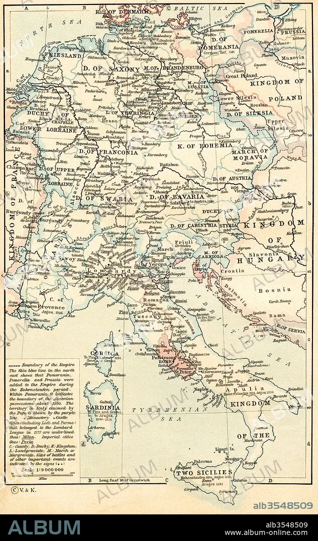
Map of The Holy Roman Empire under the Hohenstaufen, 1138-1254
| Compartir |
|---|
 Pinterest Pinterest |
 Twitter Twitter |
 Facebook Facebook |
 Copiar enlace Copiar enlace |
 Email Email |
|
Añadir a otro lightbox |
|
Añadir a otro lightbox |


¿Ya tienes cuenta? Iniciar sesión
¿No tienes cuenta? Regístrate
Compra esta imagen.
Selecciona el uso:

Título:
Map of The Holy Roman Empire under the Hohenstaufen, 1138-1254
Descripción:
Ver traducción automática
Map of The Holy Roman Empire under the Hohenstaufen, 1138 - 1254. From Historical Atlas, published 1923.
Crédito:
Album / Universal Images Group / Universal History Archive
Autorizaciones:
Tamaño imagen:
3509 x 5677 px | 57.0 MB
Tamaño impresión:
29.7 x 48.1 cm | 11.7 x 18.9 in (300 dpi)
