alb4074047
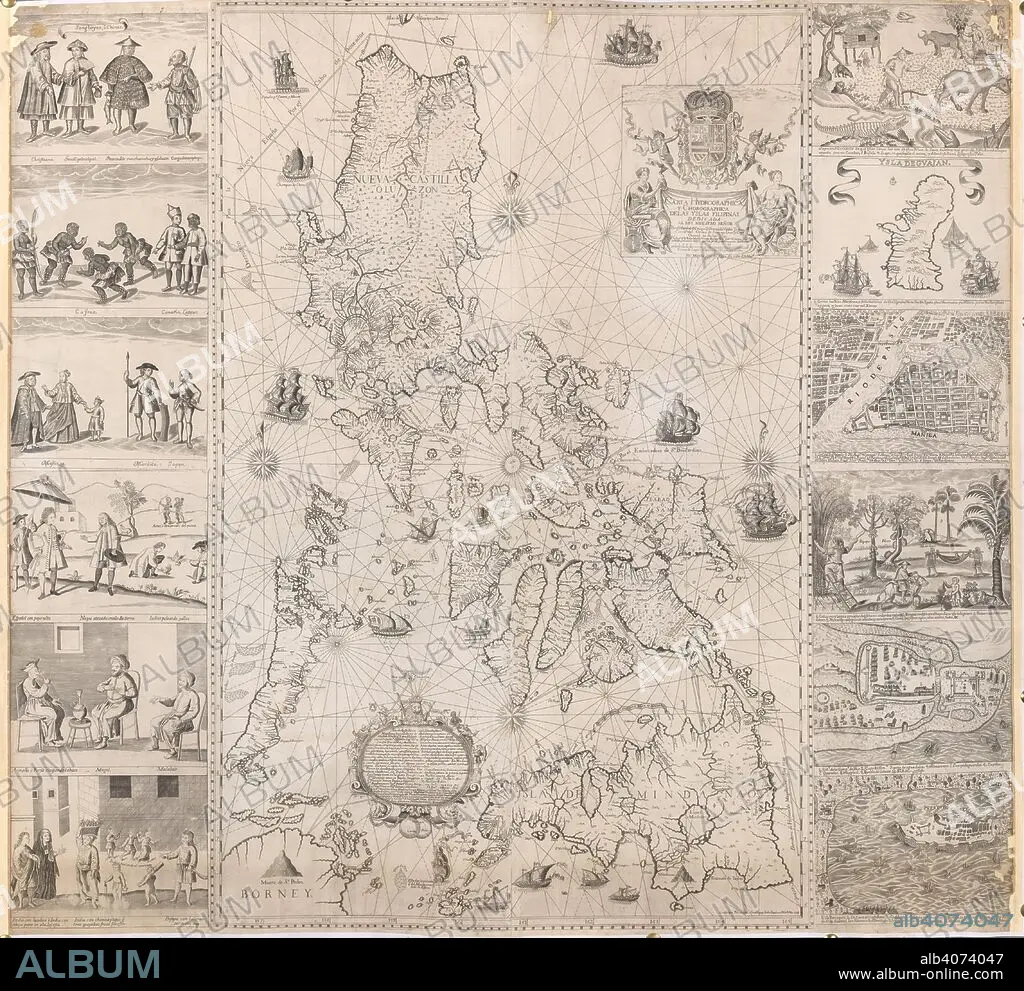
A map of the Philippine Islands with twelve marginal vignettes of illustrations of life in the Philippine Islands and plans of Guam, Cavite, Zamboanga and Manila . Carta Hydrographica, y Chorographica delas Yslas Filipinas. Manila, 1734. Source: Maps K.Top.116.37.
| Compartir |
|---|
 Pinterest Pinterest |
 Twitter Twitter |
 Facebook Facebook |
 Copiar enlace Copiar enlace |
 Email Email |
|
Añadir a otro lightbox |
|
Añadir a otro lightbox |


¿Ya tienes cuenta? Iniciar sesión
¿No tienes cuenta? Regístrate
Compra esta imagen

Descripción:
Ver traducción automática
A map of the Philippine Islands with twelve marginal vignettes of illustrations of life in the Philippine Islands and plans of Guam, Cavite, Zamboanga and Manila . Carta Hydrographica, y Chorographica delas Yslas Filipinas. Manila, 1734. Source: Maps K.Top.116.37.
Personas:
Crédito:
Album / British Library
Autorizaciones:
Modelo: No - Propiedad: No
¿Preguntas relacionadas con los derechos?
¿Preguntas relacionadas con los derechos?
Tamaño imagen:
4550 x 4170 px | 54.3 MB
Tamaño impresión:
38.5 x 35.3 cm | 15.2 x 13.9 in (300 dpi)
Palabras clave:
CARTOGRAFIA • CARTOGRAFICO • DOCUMENTO • ESCUDO DE ARMAS • FILIPINAS • HERALDICA • HERÁLDICO • ILUSTRACION • ILUSTRADO • MAPA • PLAN • S. XVIII • SIGLO XVIII
