alb5408816
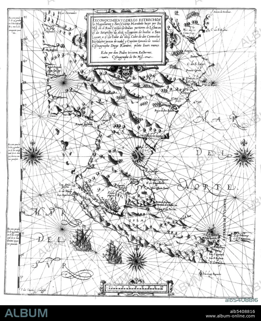
Map of the Strait of Magellan,1621
| Compartir |
|---|
 Pinterest Pinterest |
 Twitter Twitter |
 Facebook Facebook |
 Copiar enlace Copiar enlace |
 Email Email |
|
Añadir a otro lightbox |
|
Añadir a otro lightbox |


¿Ya tienes cuenta? Iniciar sesión
¿No tienes cuenta? Regístrate
Compra esta imagen.
Selecciona el uso:

Título:
Map of the Strait of Magellan,1621
Descripción:
Ver traducción automática
Entitled: "Map of the Strait of Magellan." The Strait of Magellan (Estrecho de Magallanes), also called the Straits of Magellan, is a navigable sea route separating mainland South America to the north and Tierra del Fuego to the south. Ferdinand Magellan (1480 - April 27, 1521), a Portuguese explorer and navigator in the service of Charles I of Spain, became the first European to navigate the strait in 1520 during his global circumnavigation voyage. The strait is the most important natural passage between the Atlantic and Pacific oceans. It is considered a difficult route to navigate due to the narrowness of the passage and unpredictable winds and currents. It is shorter and more sheltered than the often stormy Drake Passage. Along with the narrow and sometimes treacherous Beagle Channel, these were the only three sea routes between these two oceans until the construction of the Panama Canal. Relacion del viaj´e qve por orden de Sv Mag.d y acverdo del Real consejo de Indias (Madrid, 1621).
Crédito:
Album / Science Source
Autorizaciones:
Modelo: No - Propiedad: No
¿Preguntas relacionadas con los derechos?
¿Preguntas relacionadas con los derechos?
Tamaño imagen:
3472 x 4050 px | 40.2 MB
Tamaño impresión:
29.4 x 34.3 cm | 11.6 x 13.5 in (300 dpi)
Palabras clave:
BLANCO Y NEGRO • CARTOGRAFIA • CIRCUNNAVEGACIÓN • DESCUBRIDOR • ESTRECHO DE MAGALLANES • EXPLORACION • EXPLORADOR • FAMOSA • FAMOSO • HISTORIA • MAPA • PATAGONIA • PORTUGUES • S. XVI • SIGLO XVI • SIGLO XVII • SUDAMERICA
