alb4537440
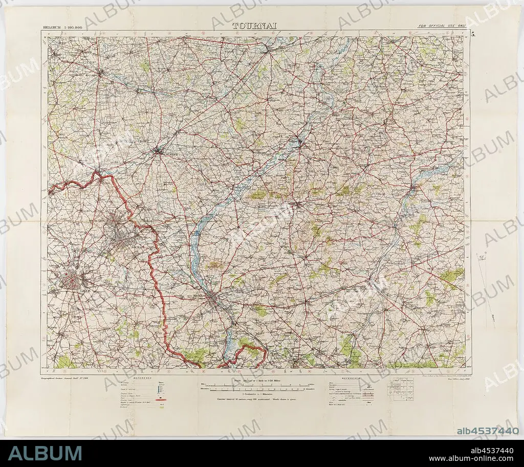
Map - Military, Belgium, Tournai 5, Scale 1:100,000, World War I, Jul 1912, Map of Belgium - Sheet Tournai, 5, scale 1:100,000. The map was photo-etched at the Ordnance Survey Office, Southampton, in 1912, and was published by the War Office, July 1912. The map is labelled Geographical Section, General Staff, No. 2364. It would have been in use during World War I. Part of the collection of World War I memorabilia donated by Sergeant John Lord (#6252). John Lord was 19.
| Compartir |
|---|
 Pinterest Pinterest |
 Twitter Twitter |
 Facebook Facebook |
 Copiar enlace Copiar enlace |
 Email Email |
|
Añadir a otro lightbox |
|
Añadir a otro lightbox |


¿Ya tienes cuenta? Iniciar sesión
¿No tienes cuenta? Regístrate
Compra esta imagen.
Selecciona el uso:

Descripción:
Ver traducción automática
Map - Military, Belgium, Tournai 5, Scale 1:100,000, World War I, Jul 1912, Map of Belgium - Sheet Tournai, 5, scale 1:100,000. The map was photo-etched at the Ordnance Survey Office, Southampton, in 1912, and was published by the War Office, July 1912. The map is labelled Geographical Section, General Staff, No. 2364. It would have been in use during World War I. Part of the collection of World War I memorabilia donated by Sergeant John Lord (#6252). John Lord was 19
Crédito:
Album / quintlox
Autorizaciones:
Tamaño imagen:
3900 x 3275 px | 36.5 MB
Tamaño impresión:
33.0 x 27.7 cm | 13.0 x 10.9 in (300 dpi)
Palabras clave:
