alb4088783
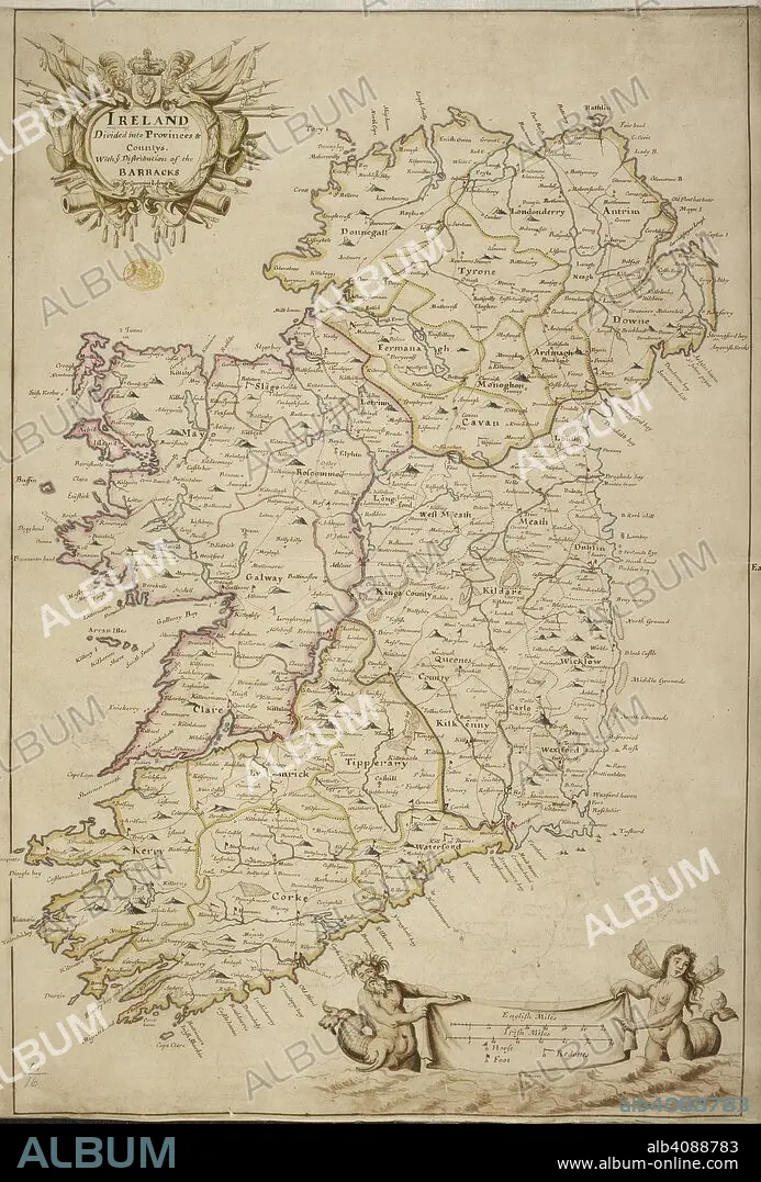
A map of Ireland divided into provinces and counties. A colored map of Ireland "divided into provinces and countys, with the distribution of the barracks for quartering the army". ca. 1700. Source: Maps K.Top.51.16. Language: English.
| Compartir |
|---|
 Pinterest Pinterest |
 Twitter Twitter |
 Facebook Facebook |
 Copiar enlace Copiar enlace |
 Email Email |
|
Añadir a otro lightbox |
|
Añadir a otro lightbox |


¿Ya tienes cuenta? Iniciar sesión
¿No tienes cuenta? Regístrate
Compra esta imagen.
Selecciona el uso:

Descripción:
Ver traducción automática
A map of Ireland divided into provinces and counties. A colored map of Ireland "divided into provinces and countys, with the distribution of the barracks for quartering the army". ca. 1700. Source: Maps K.Top.51.16. Language: English.
Crédito:
Album / British Library
Autorizaciones:
Tamaño imagen:
4518 x 6672 px | 86.2 MB
Tamaño impresión:
38.3 x 56.5 cm | 15.1 x 22.2 in (300 dpi)
Palabras clave:
