alb5405734
Africa, Cape of Good Hope,1795
| Compartir |
|---|
 Pinterest Pinterest |
 Twitter Twitter |
 Facebook Facebook |
 Copiar enlace Copiar enlace |
 Email Email |
|
Añadir a otro lightbox |
|
Añadir a otro lightbox |


¿Ya tienes cuenta? Iniciar sesión
¿No tienes cuenta? Regístrate
Compra esta imagen

Título:
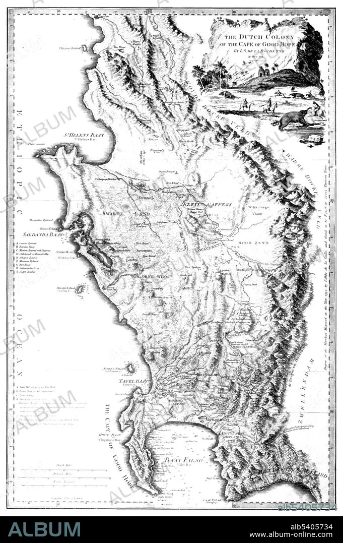
Africa, Cape of Good Hope,1795
Descripción:
Ver traducción automática
L.S. de la Rochette's map of the Cape of Good Hope. During the Napoleonic Wars, the Dutch Republic was occupied by the French in 1795. Thus the Cape Colony became a French vassal and enemy of the British. Therefore, the United Kingdom invaded and occupied the Cape Colony that same year. No biographical information can be found for Rochette. From William Faden's General Atlas, 1795. William Faden (1749 - 1836) was an English cartographer and a publisher of maps. He was the royal geographer to King George III.
Crédito:
Album / Science Source
Autorizaciones:
Modelo: No - Propiedad: No
¿Preguntas relacionadas con los derechos?
¿Preguntas relacionadas con los derechos?
Tamaño imagen:
3043 x 4575 px | 39.8 MB
Tamaño impresión:
25.8 x 38.7 cm | 10.1 x 15.2 in (300 dpi)
Palabras clave:
AFRICA • BLANCO Y NEGRO • CABO DE BUENA ESPERANZA • CARTOGRAFIA • FAMOSA • FAMOSO • GEOGRAFIA • GUERRA NAPOLEONICA • HISTORIA • ILUSTRACION • MAPA • S. XVIII • SIGLO XVIII • SUDÁFRICA
