alb1653911
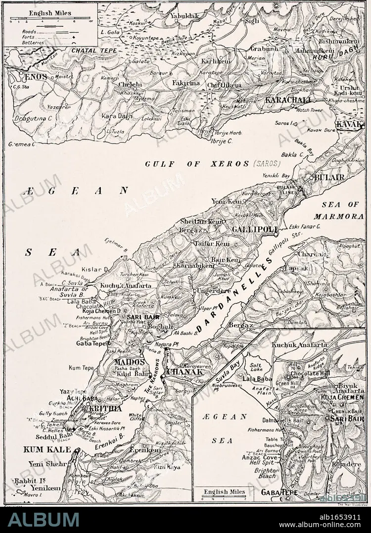
Detailed map of Gallipoli Peninsula and the Dardanelles Turkey in 1915 showing British and Allied landing beaches From The War Illustrated Album deLuxe published London 1916.
| Compartir |
|---|
 Pinterest Pinterest |
 Twitter Twitter |
 Facebook Facebook |
 Copiar enlace Copiar enlace |
 Email Email |
|
Añadir a otro lightbox |
|
Añadir a otro lightbox |


¿Ya tienes cuenta? Iniciar sesión
¿No tienes cuenta? Regístrate
Compra esta imagen.
Selecciona el uso:

Descripción:
Ver traducción automática
Detailed map of Gallipoli Peninsula and the Dardanelles Turkey in 1915 showing British and Allied landing beaches From The War Illustrated Album deLuxe published London 1916
Crédito:
Album / Universal History Archive/Universal Images Group
Autorizaciones:
Modelo: No - Propiedad: No
¿Preguntas relacionadas con los derechos?
¿Preguntas relacionadas con los derechos?
Tamaño imagen:
3780 x 5164 px | 55.8 MB
Tamaño impresión:
32.0 x 43.7 cm | 12.6 x 17.2 in (300 dpi)
Palabras clave:
ALIADO • ATERRIZAJE • BAHIA • BRITANICO • CAMPANA • CONFLICTO BELICO • DETALLADA • GABA • GUERRA MUNDIAL I • GUERRA • KEN • MAPA • MUNDO • PENINSULA • PLAYAS • PRIMERA GUERRA MUNDIAL • PRIMERA • PRIMERO • TURQUIA • WAR
