alb3936211
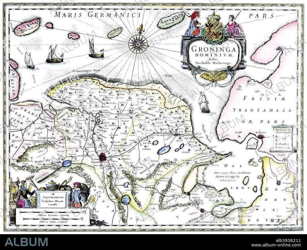
Map of Groningen, Netherlands, 17th century Artist: Unknown
| Compartir |
|---|
 Pinterest Pinterest |
 Twitter Twitter |
 Facebook Facebook |
 Copiar enlace Copiar enlace |
 Email Email |
|
Añadir a otro lightbox |
|
Añadir a otro lightbox |


¿Ya tienes cuenta? Iniciar sesión
¿No tienes cuenta? Regístrate
Compra esta imagen.
Selecciona el uso:

Título:
Map of Groningen, Netherlands, 17th century Artist: Unknown
Descripción:
Ver traducción automática
Map of Groningen, Netherlands, 17th century. A map of the Dutch province of Groningen, published by Willem Blaeu after the original design by Barthold Wicheringe.
Crédito:
Album / Print Collector / Heritage Images
Autorizaciones:
Tamaño imagen:
4777 x 3659 px | 50.0 MB
Tamaño impresión:
40.4 x 31.0 cm | 15.9 x 12.2 in (300 dpi)
Palabras clave:
CARTOGRAFIA • COSTA • GEOGRAFIA • GRONINGA • HOLANDA • HOLANDES • MAPA • MAR DEL NORTE • MAR • PAÍS • PAISES BAJOS • SIGLO XVII • SIGLO • WILLEM BLAEU
