alb10640358
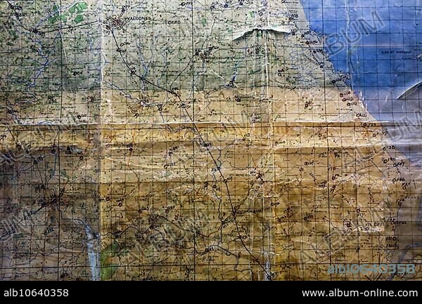
Utah Beach Ordnance Survey map annotated by general Raymond Barton during the D-Day invasion in Normandy, France, Europe.
| Compartir |
|---|
 Pinterest Pinterest |
 Twitter Twitter |
 Facebook Facebook |
 Copiar enlace Copiar enlace |
 Email Email |
|
Añadir a otro lightbox |
|
Añadir a otro lightbox |


¿Ya tienes cuenta? Iniciar sesión
¿No tienes cuenta? Regístrate
Compra esta imagen

Descripción:
Ver traducción automática
Utah Beach Ordnance Survey map annotated by general Raymond Barton during the D-Day invasion in Normandy, France, Europe
Crédito:
Album / ImageBroker / alimdi / Arterra / Philippe Clément
Autorizaciones:
Modelo: No - Propiedad: No
¿Preguntas relacionadas con los derechos?
¿Preguntas relacionadas con los derechos?
Tamaño imagen:
600 x 400 px | 703.1 KB
Tamaño impresión:
5.1 x 3.4 cm | 2.0 x 1.3 in (300 dpi)
Palabras clave:
1939-1945 • COSTA • DESHABITADO • EUROPA OCCIDENTAL • FRANCIA • FRENTE A LA PLAYA • GENERAL • GUERRA MUNDIAL • HISTORIA • HISTORICO • MAPA • MILITAR • NADIE • NAVEGACION • NORMANDIA • ORIENTACION • PLAYA • PLAYAS • REFUNDS GUERRA MUNDIAL • SEGUNDA GUERRA MUNDIAL • SIN GENTE • VACIAS
