alb3547759
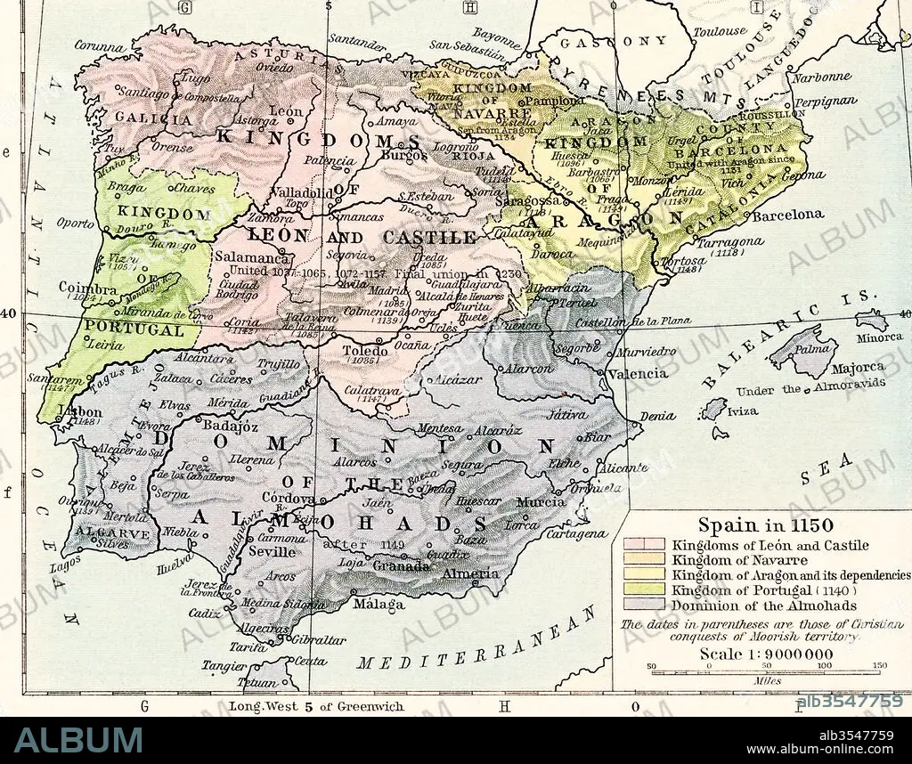
Map of Spain in 1150, showing the kingdoms of León and Castile, kingdom of Navarre, kingdoms of Aragon and its dependencies, kingdom of Portugal in 1140 and Dominion of the Almohads
| Compartir |
|---|
 Pinterest Pinterest |
 Twitter Twitter |
 Facebook Facebook |
 Copiar enlace Copiar enlace |
 Email Email |
|
Añadir a otro lightbox |
|
Añadir a otro lightbox |


¿Ya tienes cuenta? Iniciar sesión
¿No tienes cuenta? Regístrate
Compra esta imagen.
Selecciona el uso:

Título:
Map of Spain in 1150, showing the kingdoms of León and Castile, kingdom of Navarre, kingdoms of Aragon and its dependencies, kingdom of Portugal in 1140 and Dominion of the Almohads
Descripción:
Ver traducción automática
Map of Spain in 1150, showing the kingdoms of León and Castile, kingdom of Navarre, kingdoms of Aragon and its dependencies, kingdom of Portugal in 1140 and Dominion of the Almohads. From Historical Atlas, published 1923.
Crédito:
Album / Universal Images Group / Universal History Archive
Autorizaciones:
Modelo: No - Propiedad: No
¿Preguntas relacionadas con los derechos?
¿Preguntas relacionadas con los derechos?
Tamaño imagen:
4898 x 3849 px | 53.9 MB
Tamaño impresión:
41.5 x 32.6 cm | 16.3 x 12.8 in (300 dpi)
