alb4065584
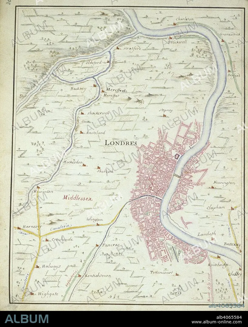
Map of London. Invasion of England by the Prince of Orange. 1688. (Whole map) Map of London, between Chelsea and Charlton; showing the route of William of Orange into London from Knightsbridge on the 28 December 1688 Image taken from Invasion of England by the Prince of Orange Originally published/produced in 1688. . Source: Add. 33970, f.30. Language: French.
| Compartir |
|---|
 Pinterest Pinterest |
 Twitter Twitter |
 Facebook Facebook |
 Copiar enlace Copiar enlace |
 Email Email |
|
Añadir a otro lightbox |
|
Añadir a otro lightbox |


¿Ya tienes cuenta? Iniciar sesión
¿No tienes cuenta? Regístrate
Compra esta imagen

Descripción:
Ver traducción automática
Map of London. Invasion of England by the Prince of Orange. 1688. (Whole map) Map of London, between Chelsea and Charlton; showing the route of William of Orange into London from Knightsbridge on the 28 December 1688 Image taken from Invasion of England by the Prince of Orange Originally published/produced in 1688. . Source: Add. 33970, f.30. Language: French.
Crédito:
Album / British Library
Autorizaciones:
Modelo: No - Propiedad: No
¿Preguntas relacionadas con los derechos?
¿Preguntas relacionadas con los derechos?
Tamaño imagen:
4065 x 5094 px | 59.2 MB
Tamaño impresión:
34.4 x 43.1 cm | 13.6 x 17.0 in (300 dpi)
Palabras clave:
