alb3546299
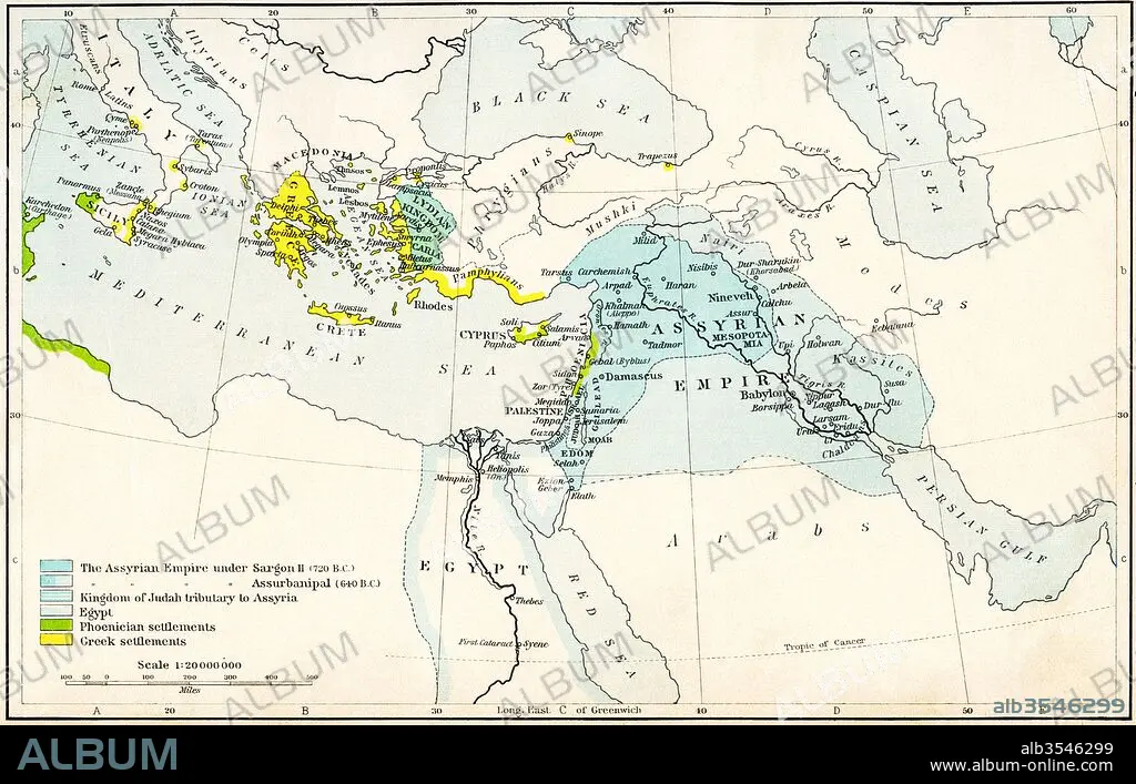
Map of the Assyrian Empire and the region around the eastern Mediterranean, 750-625 B
| Compartir |
|---|
 Pinterest Pinterest |
 Twitter Twitter |
 Facebook Facebook |
 Copiar enlace Copiar enlace |
 Email Email |
|
Añadir a otro lightbox |
|
Añadir a otro lightbox |


¿Ya tienes cuenta? Iniciar sesión
¿No tienes cuenta? Regístrate
Compra esta imagen

Título:
Map of the Assyrian Empire and the region around the eastern Mediterranean, 750-625 B
Descripción:
Ver traducción automática
Map of the Assyrian Empire and the region around the eastern Mediterranean, 750 - 625 B.C. From Historical Atlas, published 1923.
Crédito:
Album / Universal Images Group / Universal History Archive
Autorizaciones:
Modelo: No - Propiedad: No
¿Preguntas relacionadas con los derechos?
¿Preguntas relacionadas con los derechos?
Tamaño imagen:
5362 x 3425 px | 52.5 MB
Tamaño impresión:
45.4 x 29.0 cm | 17.9 x 11.4 in (300 dpi)
