alb3178860
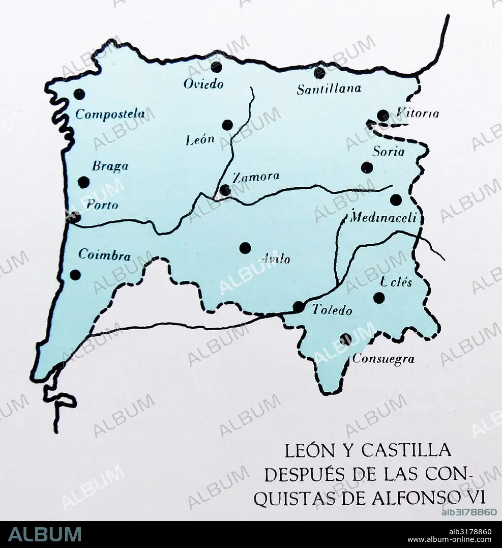
Map showing the Spanish provinces of Leon and Castille at the time of King Alfonso VI
| Compartir |
|---|
 Pinterest Pinterest |
 Twitter Twitter |
 Facebook Facebook |
 Copiar enlace Copiar enlace |
 Email Email |
|
Añadir a otro lightbox |
|
Añadir a otro lightbox |


¿Ya tienes cuenta? Iniciar sesión
¿No tienes cuenta? Regístrate
Compra esta imagen.
Selecciona el uso:

Título:
Map showing the Spanish provinces of Leon and Castille at the time of King Alfonso VI
Descripción:
Ver traducción automática
Map showing the Spanish provinces of Leon and Castille at the time of King Alfonso VI. Alfonso VI (before June 1040 – 29 June/1 July 1109), nicknamed the Brave (El Bravo) or the Valiant, was King of León from 1065, King of Castile and de facto King of Galicia from 1072. After the conquest of Toledo in 1085 he was also the self-proclaimed victoriosissimo rege in Toleto, et in Hispania et Gallecia (most victorious king of Toledo, and of Spain and Galicia).[
Crédito:
Album / Universal Images Group / Universal History Archive
Autorizaciones:
Modelo: No - Propiedad: No
¿Preguntas relacionadas con los derechos?
¿Preguntas relacionadas con los derechos?
Tamaño imagen:
4497 x 4664 px | 60.0 MB
Tamaño impresión:
38.1 x 39.5 cm | 15.0 x 15.5 in (300 dpi)
