alb3809877
Map of the Americas, 1640
| Compartir |
|---|
 Pinterest Pinterest |
 Twitter Twitter |
 Facebook Facebook |
 Copiar enlace Copiar enlace |
 Email Email |
|
Añadir a otro lightbox |
|
Añadir a otro lightbox |


¿Ya tienes cuenta? Iniciar sesión
¿No tienes cuenta? Regístrate
Compra esta imagen.
Selecciona el uso:

Título:
Map of the Americas, 1640
Descripción:
Ver traducción automática
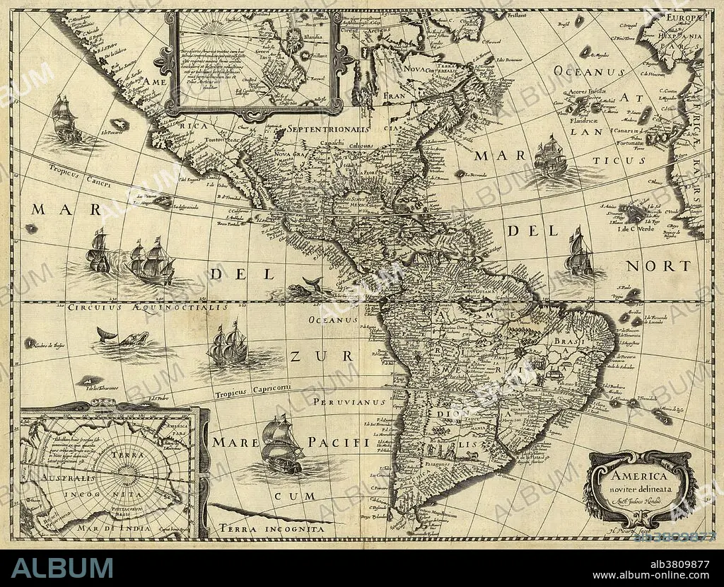
17th century map of the Americas. Published in Paris around 1640, this map is by the Flemish cartographer Jodocus Hondius (1563-1612). The map shows the geography of the Americas, the New World being explored by Europeans. Most of Central and South America, and southern North America, were under Spanish control, but large parts of eastern North America were part of the French colony of New France. The map title is at lower right, with insets at lower left and upper center showing the southern and northern polar regions. Artworks of sailing ships are shown on the sea, along with sea monsters. The inscriptions are in Latin.
Personas:
Crédito:
Album / Science Source / LOC/Geography and Map Division
Autorizaciones:
Modelo: No - Propiedad: No
¿Preguntas relacionadas con los derechos?
¿Preguntas relacionadas con los derechos?
Tamaño imagen:
5488 x 4166 px | 65.4 MB
Tamaño impresión:
46.5 x 35.3 cm | 18.3 x 13.9 in (300 dpi)
Palabras clave:
AMÉRICA DEL NORTE • AMERICA • CARTOGRAFIA • COLONIA (TERRITORIO) • COLONIALISMO • CONTINENTAL • CONTINENTE • CONTINENTES • EDAD MEDIA • ESPANOL • EXPLORACION • FLAMENCO (DE FLANDES) • FRANCES • GEOGRAFIA • GEOGRAFICO • HISTORIA • HISTORICO • HOLANDES • HORIZONTAL • IMPERIO • MAPA • MEDIEVAL • NORTEAMERICA • NUEVA FRANCIA • SIGLO XVII • SUDAMERICA • SUDAMERICANO • SUDAMERICANOS
