alb3546931
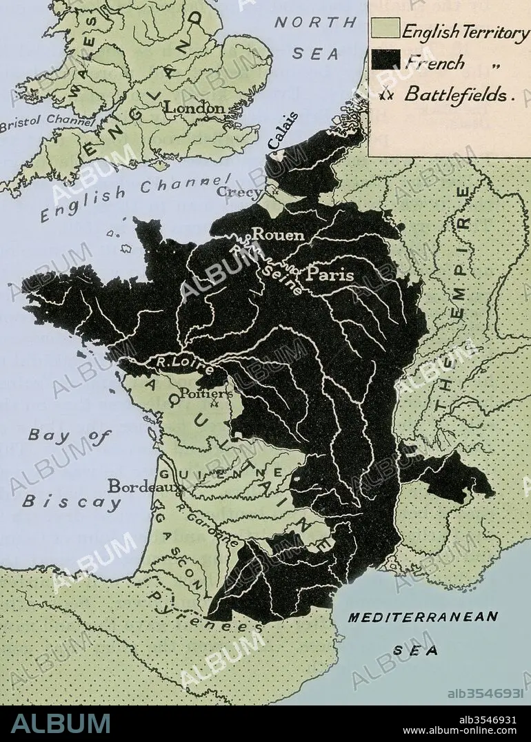
Map showing the English dominions in France after the Treaty of Calais in 1360
| Compartir |
|---|
 Pinterest Pinterest |
 Twitter Twitter |
 Facebook Facebook |
 Copiar enlace Copiar enlace |
 Email Email |
|
Añadir a otro lightbox |
|
Añadir a otro lightbox |


¿Ya tienes cuenta? Iniciar sesión
¿No tienes cuenta? Regístrate
Compra esta imagen.
Selecciona el uso:

Título: Map showing the English dominions in France after the Treaty of Calais in 1360
Descripción: Ver traducción automática
Map showing the English dominions in France after the Treaty of Calais in 1360. From A First Book of British History published 1925.
Map showing the English dominions in France after the Treaty of Calais in 1360. From A First Book of British History published 1925.
Crédito: Album / Universal Images Group / Universal History Archive
Autorizaciones: ? Cesión de modelo: No - ? Cesión de propiedad: No
¿Preguntas relacionadas con los derechos?
¿Preguntas relacionadas con los derechos?
Tamaño imagen: 3707 × 4930 px | 52.3 MB
Tamaño impresión: 31.4 × 41.7 cm | 1459.4 × 1940.9 in (300 dpi)
