alb9843503
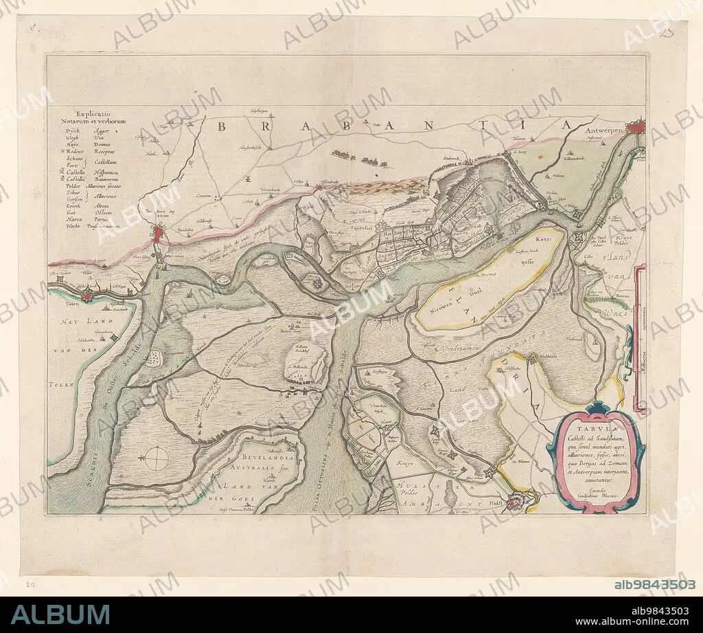
WILLEM BLAEU. Map of the surroundings of Zandvliet, 1642. Creator: Willem Blaeu.
| Compartir |
|---|
 Pinterest Pinterest |
 Twitter Twitter |
 Facebook Facebook |
 Copiar enlace Copiar enlace |
 Email Email |
|
Añadir a otro lightbox |
|
Añadir a otro lightbox |


¿Ya tienes cuenta? Iniciar sesión
¿No tienes cuenta? Regístrate
Compra esta imagen.
Selecciona el uso:

Autor:
Título:
Map of the surroundings of Zandvliet, 1642. Creator: Willem Blaeu.
Descripción:
Ver traducción automática
Map of the surroundings of Zandvliet, 1642. The north on the left, the borders coloured, cities, buildings and flags indicated. At the top left Explanation of the symbols on the map.
Crédito:
Album / Heritage Art/Heritage Images
Autorizaciones:
Modelo: No - Propiedad: No
¿Preguntas relacionadas con los derechos?
¿Preguntas relacionadas con los derechos?
Tamaño imagen:
4974 x 4214 px | 60.0 MB
Tamaño impresión:
42.1 x 35.7 cm | 16.6 x 14.0 in (300 dpi)
Palabras clave:
ARTE • ARTES • BANDERA • BANDERAS • BARROCO • BELGA • BELGICA • BLAEU, WILLEM • CAMINOS • CARRETERA • CIUDAD • CIUDADES • COLOR • COLORIDO • CONCEPTO • DIBUJO • EDIFICIO • EDIFICIOS • ESTÁNDAR • EUROPA • HISTORIA • HISTORICO • HOLANDES • MAPA • MUSEO • PAÍS • PAISES BAJOS • PAPEL • RIJKSMUSEUM • SIGLO XVII • SIGLO • SIMBOLO • SIMBOLOS • WILLEM BLAEU
