alb4067008
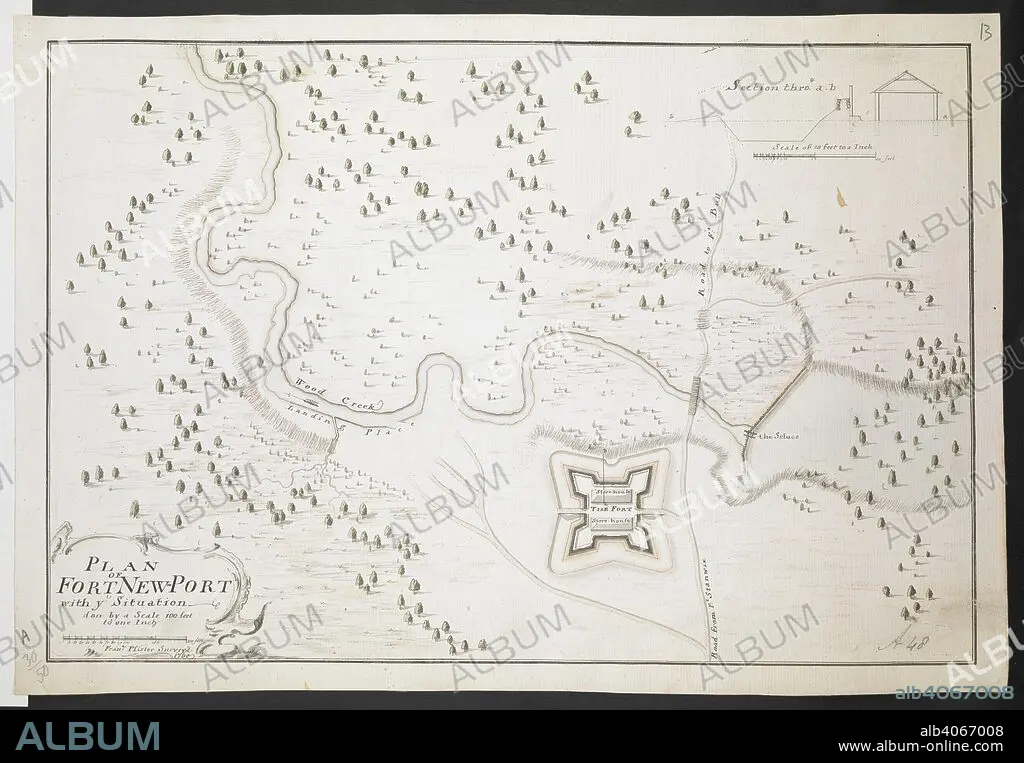
Plan of Fort Newport Fran. Pfister surv. 1760'. 1:1200. 'Scale 100 feet to one inch'. Scale bar of 200 feet (= 2 inches). 255 x 380mm. . R.U.S.I. MAPS. Vol. LXXVI (1-13). 57711 (1-4). Places in states North-East of New York. 18th century. 1760. Source: Add. 57711.13 Amherst no. A 48. R.U.S.I. no. A 30.50.
| Compartir |
|---|
 Pinterest Pinterest |
 Twitter Twitter |
 Facebook Facebook |
 Copiar enlace Copiar enlace |
 Email Email |
|
Añadir a otro lightbox |
|
Añadir a otro lightbox |


¿Ya tienes cuenta? Iniciar sesión
¿No tienes cuenta? Regístrate
Compra esta imagen.
Selecciona el uso:

Descripción:
Ver traducción automática
Plan of Fort Newport Fran. Pfister surv. 1760'. 1:1200. 'Scale 100 feet to one inch'. Scale bar of 200 feet (= 2 inches). 255 x 380mm. . R.U.S.I. MAPS. Vol. LXXVI (1-13). 57711 (1-4). Places in states North-East of New York. 18th century. 1760. Source: Add. 57711.13 Amherst no. A 48. R.U.S.I. no. A 30.50.
Crédito:
Album / British Library
Autorizaciones:
Tamaño imagen:
8761 x 6074 px | 152.2 MB
Tamaño impresión:
74.2 x 51.4 cm | 29.2 x 20.2 in (300 dpi)
Palabras clave:
ACONTECIMIENTO • AMÉRICA DEL NORTE • AMERICA SEPTENTRIONAL • CARTOGRAFIA • CARTOGRAFICO • COMBATE • CONFLICTO ARMADO • CONFLICTO BELICO • CONFLICTOS ARMADOS • DOCUMENTO • EVENTO MILITAR • EVENTOS MILITARES • GUERRA • GUERRAS • MAPA • MAPAS • MILITAR • NADIE • NORTEAMERICA • S. XVIII • SIGLO XVIII • WAR
