alb4072425
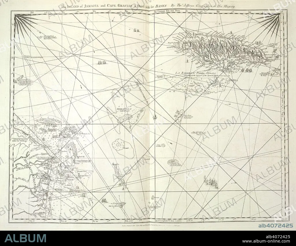
'The Island of Jamaica and Cape Gracias a Dios with the Banks'. The West-India Atlas: or, a compendious description of the West-Indies: illustrated with forty correct charts and maps ... together with an historical account of the various countries and islands ... By the late Thomas Jefferys, etc. London : Robert Sayer & John Bennett, 1775. Source: Maps C.11.b.18, no.16. Language: English.
| Compartir |
|---|
 Pinterest Pinterest |
 Twitter Twitter |
 Facebook Facebook |
 Copiar enlace Copiar enlace |
 Email Email |
|
Añadir a otro lightbox |
|
Añadir a otro lightbox |


¿Ya tienes cuenta? Iniciar sesión
¿No tienes cuenta? Regístrate
Compra esta imagen.
Selecciona el uso:

Descripción:
Ver traducción automática
'The Island of Jamaica and Cape Gracias a Dios with the Banks'. The West-India Atlas: or, a compendious description of the West-Indies: illustrated with forty correct charts and maps ... together with an historical account of the various countries and islands ... By the late Thomas Jefferys, etc. London : Robert Sayer & John Bennett, 1775. Source: Maps C.11.b.18, no.16. Language: English.
Crédito:
Album / British Library
Autorizaciones:
Tamaño imagen:
5880 x 4579 px | 77.0 MB
Tamaño impresión:
49.8 x 38.8 cm | 19.6 x 15.3 in (300 dpi)
Palabras clave:
ATLANTICO • CARIBE • CARTOGRAFIA • CARTOGRAFICO • INDIAS OCCIDENTALES • JAMAICA • JEFFERYS, THOMAS • MAPA • MAPAS • MAR CARIBE • OCEANO ATLANTICO • S. XVIII • SIGLO XVIII
