alb3547973
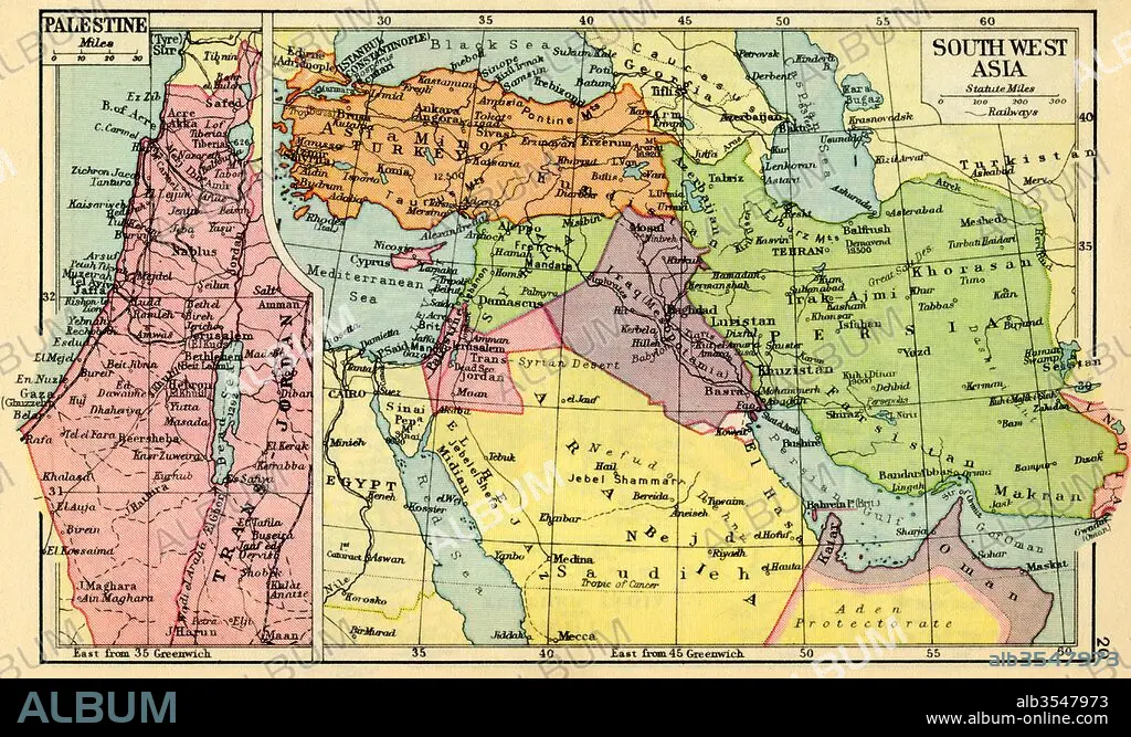
A 1930's map of Palestine, left and south west Asia, right
| Compartir |
|---|
 Pinterest Pinterest |
 Twitter Twitter |
 Facebook Facebook |
 Copiar enlace Copiar enlace |
 Email Email |
|
Añadir a otro lightbox |
|
Añadir a otro lightbox |


¿Ya tienes cuenta? Iniciar sesión
¿No tienes cuenta? Regístrate
Compra esta imagen.
Selecciona el uso:

Título: A 1930's map of Palestine, left and south west Asia, right
Descripción: Ver traducción automática
A 1930's map of Palestine, left and south west Asia, right.
A 1930's map of Palestine, left and south west Asia, right.
Crédito: Album / Universal Images Group / Universal History Archive
Autorizaciones: ? Cesión de modelo: No - ? Cesión de propiedad: No
¿Preguntas relacionadas con los derechos?
¿Preguntas relacionadas con los derechos?
Tamaño imagen: 5797 × 3478 px | 57.7 MB
Tamaño impresión: 49.1 × 29.4 cm | 2282.3 × 1369.3 in (300 dpi)
Palabras clave: ASIA • ASIATICO • AÑOS TREINTA • GEOGRAFIA • GEOGRAFICO • HISTORIA • HISTORICO • ILUSTRACION • ILUSTRACIONES • MAPA • MAPAS • OESTE • PAÍS • PAISES • PALESTINA • S. XX • SIGLO XX • SIGLO • SUR
