alb4091442
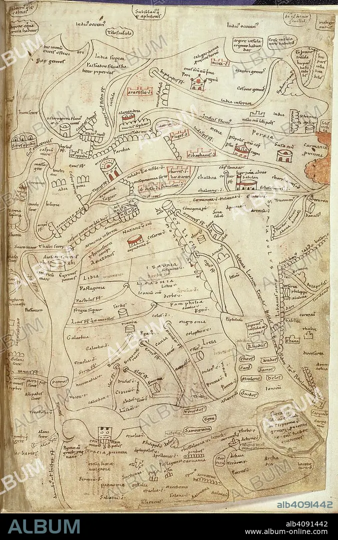
Jerome map of Asia. Works of St Jerome. France?; 12th century. (Whole folio) Map of Greece, Asia Minor, Syria, Persia and India. At the top of the map are India and the Indian Ocean with Alexandria and Damascus in the centre.The lower part of the map shows the Black Sea, Greece and Aegean Sea, and Eastern Mediterranean. Rows of semicircles represent mountains Image taken from Works of St Jerome. Originally published/produced in France?; 12th century. . Source: Add. 10049, f.64. Language: Latin.
| Compartir |
|---|
 Pinterest Pinterest |
 Twitter Twitter |
 Facebook Facebook |
 Copiar enlace Copiar enlace |
 Email Email |
|
Añadir a otro lightbox |
|
Añadir a otro lightbox |


¿Ya tienes cuenta? Iniciar sesión
¿No tienes cuenta? Regístrate
Compra esta imagen.
Selecciona el uso:

Descripción:
Ver traducción automática
Jerome map of Asia. Works of St Jerome. France?; 12th century. (Whole folio) Map of Greece, Asia Minor, Syria, Persia and India. At the top of the map are India and the Indian Ocean with Alexandria and Damascus in the centre.The lower part of the map shows the Black Sea, Greece and Aegean Sea, and Eastern Mediterranean. Rows of semicircles represent mountains Image taken from Works of St Jerome. Originally published/produced in France?; 12th century. . Source: Add. 10049, f.64. Language: Latin.
Crédito:
Album / British Library
Autorizaciones:
Tamaño imagen:
1851 x 2806 px | 14.9 MB
Tamaño impresión:
15.7 x 23.8 cm | 6.2 x 9.4 in (300 dpi)
Palabras clave:
AFRICA DEL NORTE • AFRICA NORTE • AFRICA • ALEJANDRIA • ASIA • CARTOGRAFIA • COLOR • COLORIDO • EGIPCIA • EGIPCIAS • EGIPCIO • EGIPTO • FLOTA • GRECIA • IRAN • MAPA • MAPAS • MAR • MARINA • MARINE • MITOLOGIA: PERSA • NEGRO • NORTE AFRICA • NORTE DE AFRICA • NORTH AFRICA • OCEANO • PERSA • PERSAS • PERSIA • SEA • SIRIA • TOPOGRAFIA
