alb4397710
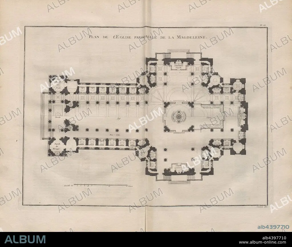
Map of The Parish Church of La Magdeleine, Illustration of the plan of the church La Madeleine from the 18th century, signed: Contant Inv, Pl. IX, after p. 128, Contant (inv.), 1765, Pierre Patte: Monumens érigés en France à la gloire de Louis XV. Paris: chez l'auteur: chez Desaint: chez Saillant, 1765.
| Compartir |
|---|
 Pinterest Pinterest |
 Twitter Twitter |
 Facebook Facebook |
 Copiar enlace Copiar enlace |
 Email Email |
|
Añadir a otro lightbox |
|
Añadir a otro lightbox |


¿Ya tienes cuenta? Iniciar sesión
¿No tienes cuenta? Regístrate
Compra esta imagen.
Selecciona el uso:

Descripción: Ver traducción automática
Map of The Parish Church of La Magdeleine, Illustration of the plan of the church La Madeleine from the 18th century, signed: Contant Inv, Pl. IX, after p. 128, Contant (inv.), 1765, Pierre Patte: Monumens érigés en France à la gloire de Louis XV. Paris: chez l'auteur: chez Desaint: chez Saillant, 1765
Map of The Parish Church of La Magdeleine, Illustration of the plan of the church La Madeleine from the 18th century, signed: Contant Inv, Pl. IX, after p. 128, Contant (inv.), 1765, Pierre Patte: Monumens érigés en France à la gloire de Louis XV. Paris: chez l'auteur: chez Desaint: chez Saillant, 1765
Crédito: Album / quintlox
Autorizaciones: ? Cesión de modelo: No - ? Cesión de propiedad: No
¿Preguntas relacionadas con los derechos?
¿Preguntas relacionadas con los derechos?
Tamaño imagen: 5706 × 4543 px | 74.2 MB
Tamaño impresión: 48.3 × 38.5 cm | 2246.5 × 1788.6 in (300 dpi)
Palabras clave: 1765 • IGLESIA PARROQUIAL • ILUSTRACION • ILUSTRACIONES • MAPA • MAPAS • PARIS • S. XVIII • SIGLO XVIII
