alb3818722
Western Roman Empire, 3rd Century
| Compartir |
|---|
 Pinterest Pinterest |
 Twitter Twitter |
 Facebook Facebook |
 Copiar enlace Copiar enlace |
 Email Email |
|
Añadir a otro lightbox |
|
Añadir a otro lightbox |


¿Ya tienes cuenta? Iniciar sesión
¿No tienes cuenta? Regístrate
Compra esta imagen

Título:
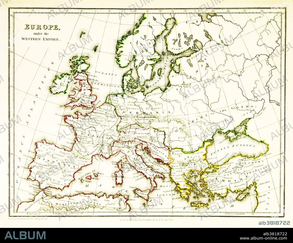
Western Roman Empire, 3rd Century
Descripción:
Ver traducción automática
A map of Europe, showing the borders of the Western Roman Empire, which reached its greatest extent around 400 CE. A Western Roman Empire existed intermittently in several periods between the 3rd and 5th centuries (285 - 476 CE). Map published in 1831.
Crédito:
Album / Science Source / British Library
Autorizaciones:
Modelo: No - Propiedad: No
¿Preguntas relacionadas con los derechos?
¿Preguntas relacionadas con los derechos?
Tamaño imagen:
3543 x 2766 px | 28.0 MB
Tamaño impresión:
30.0 x 23.4 cm | 11.8 x 9.2 in (300 dpi)
Palabras clave:
ANTIGUO • ANTIGÜEDAD • ARTE • ASIGNACIÓN • CARTOGRAFIA • CIVILIZACION ANTIGUA • CULTURA ANTIGUA • DIBUJO • EUROPA • EUROPEO • FAMOSO • GEOGRAFIA • GEOGRAFICA • GEOGRAFICO • HISTORIA • HISTORICO • ILUSTRACION • IMPERIO ROMANO • IMPORTANTE • MAPA • OBRA DE ARTE • PERIODO HELENISTICO • ROMANO • SIGLO-III
