alb9354753
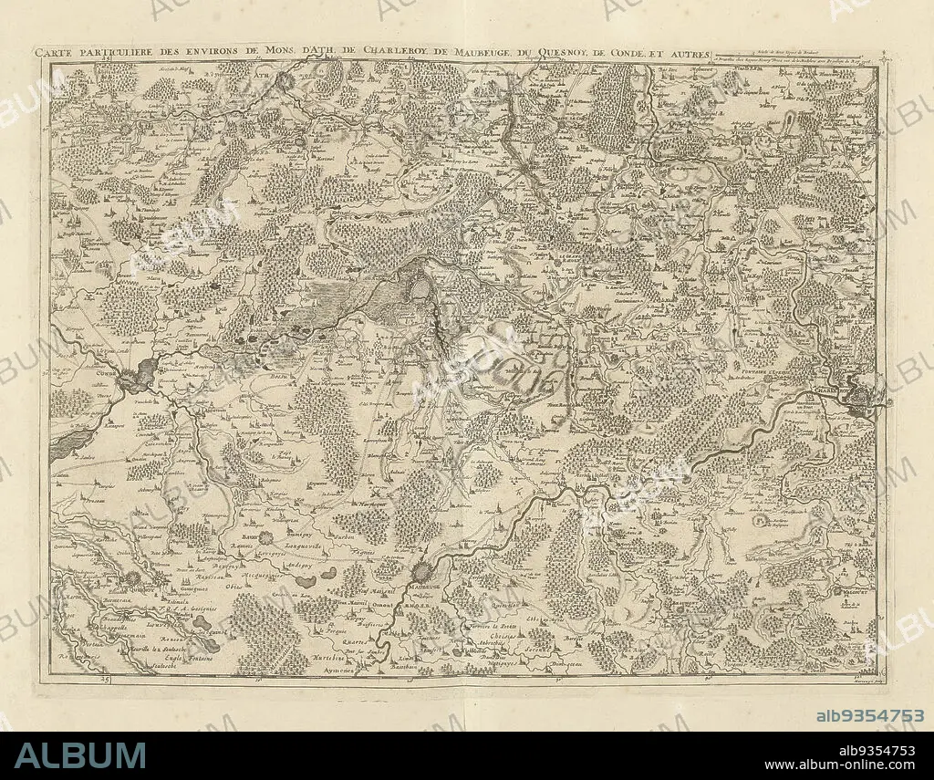
Map of Hainaut and Northern France, 1706, Carte particuliere des environs de Mons, d'Ath, de Charleroy, de Maubeuge, du Quesnoy, de Condé, et autres (title on object), Map of Hainaut and Northern France with the towns of Mons, Ath, Charleroi, Maubeuge, le Quesnoy and Condé, 1706. Part of a bundled collection of plans of battles and cities renowned in the War of the Spanish Succession. This plate is among the first 24 plates that make up a very large map of the Southern Netherlands., print maker: Jacobus Harrewijn (mentioned on object), publisher: Eugene Henry Fricx (mentioned on object), Brussels, 1706, paper, etching, engraving, height 428 mm × width 565 mm.
| Compartir |
|---|
 Pinterest Pinterest |
 Twitter Twitter |
 Facebook Facebook |
 Copiar enlace Copiar enlace |
 Email Email |
|
Añadir a otro lightbox |
|
Añadir a otro lightbox |


¿Ya tienes cuenta? Iniciar sesión
¿No tienes cuenta? Regístrate
Compra esta imagen.
Selecciona el uso:

Descripción: Ver traducción automática
Map of Hainaut and Northern France, 1706, Carte particuliere des environs de Mons, d'Ath, de Charleroy, de Maubeuge, du Quesnoy, de Condé, et autres (title on object), Map of Hainaut and Northern France with the towns of Mons, Ath, Charleroi, Maubeuge, le Quesnoy and Condé, 1706. Part of a bundled collection of plans of battles and cities renowned in the War of the Spanish Succession. This plate is among the first 24 plates that make up a very large map of the Southern Netherlands., print maker: Jacobus Harrewijn (mentioned on object), publisher: Eugene Henry Fricx (mentioned on object), Brussels, 1706, paper, etching, engraving, height 428 mm × width 565 mm
Map of Hainaut and Northern France, 1706, Carte particuliere des environs de Mons, d'Ath, de Charleroy, de Maubeuge, du Quesnoy, de Condé, et autres (title on object), Map of Hainaut and Northern France with the towns of Mons, Ath, Charleroi, Maubeuge, le Quesnoy and Condé, 1706. Part of a bundled collection of plans of battles and cities renowned in the War of the Spanish Succession. This plate is among the first 24 plates that make up a very large map of the Southern Netherlands., print maker: Jacobus Harrewijn (mentioned on object), publisher: Eugene Henry Fricx (mentioned on object), Brussels, 1706, paper, etching, engraving, height 428 mm × width 565 mm
Personas: JACOBUS HARREWIJN
Crédito: Album / quintlox
Autorizaciones: ? Cesión de modelo: No - ? Cesión de propiedad: No
¿Preguntas relacionadas con los derechos?
¿Preguntas relacionadas con los derechos?
Tamaño imagen: 4896 × 3834 px | 53.7 MB
Tamaño impresión: 41.5 × 32.5 cm | 1927.6 × 1509.4 in (300 dpi)
Palabras clave: AGUAFUERTE • BATALLAS • BRUSELAS • CIUDAD • CONFLICTO BELICO • EDITOR • ENGRAVING • GRABADO • GRABADOS • GUERRA • GUERRAS • HENAO • JACOBUS HARREWIJN • MAPA • MAPAS • MONTE DE VENUS • PAPEL • PLANES • PLATO • WAR
