alb8368675
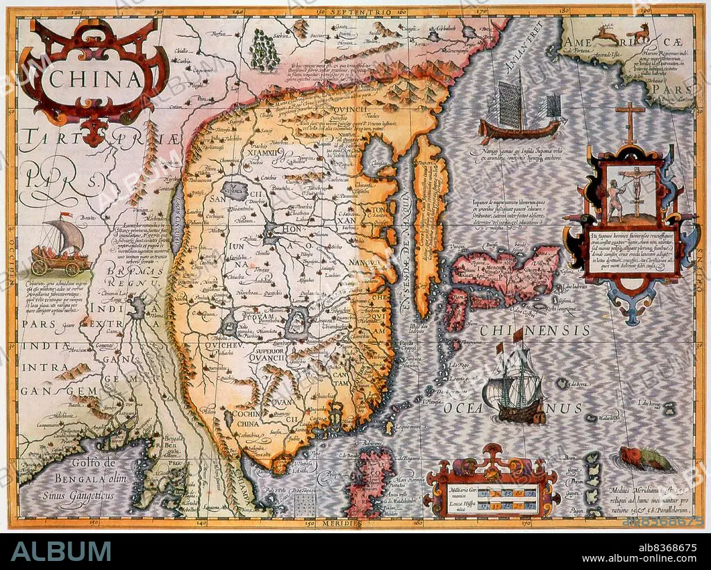
China: A hand coloured 17th century map of Japan, Korea, China and the Yunnan-Burma region from an original copper engraving by Gerard Mercator and published by Jodocus Hondius
| Compartir |
|---|
 Pinterest Pinterest |
 Twitter Twitter |
 Facebook Facebook |
 Copiar enlace Copiar enlace |
 Email Email |
|
Añadir a otro lightbox |
|
Añadir a otro lightbox |


¿Ya tienes cuenta? Iniciar sesión
¿No tienes cuenta? Regístrate
Compra esta imagen.
Selecciona el uso:

Título:
China: A hand coloured 17th century map of Japan, Korea, China and the Yunnan-Burma region from an original copper engraving by Gerard Mercator and published by Jodocus Hondius
Descripción:
Ver traducción automática
Gerardus Mercator, a Flemish German (5 March 1512 2 December 1594) was a cartographer renowned for creating a world map based on a new projection which represented sailing courses of constant bearing as straight linesan innovation that is still employed in nautical charts used for navigation.
. Jodocus Hondius (Dutch name: Joost de Hondt) (1563 1612) was a Flemish engraver and cartographer. He helped establish Amsterdam as the center of cartography in Europe in the 17th century.
. Jodocus Hondius (Dutch name: Joost de Hondt) (1563 1612) was a Flemish engraver and cartographer. He helped establish Amsterdam as the center of cartography in Europe in the 17th century.
Crédito:
Album / Universal Images Group / Pictures From History
Autorizaciones:
Modelo: No - Propiedad: No
¿Preguntas relacionadas con los derechos?
¿Preguntas relacionadas con los derechos?
Tamaño imagen:
4771 x 3576 px | 48.8 MB
Tamaño impresión:
40.4 x 30.3 cm | 15.9 x 11.9 in (300 dpi)
