alb6386975
Römisches Reich im 3.Jh. / Landkarte
| Compartir |
|---|
 Pinterest Pinterest |
 Twitter Twitter |
 Facebook Facebook |
 Copiar enlace Copiar enlace |
 Email Email |
|
Añadir a otro lightbox |
|
Añadir a otro lightbox |


¿Ya tienes cuenta? Iniciar sesión
¿No tienes cuenta? Regístrate
Compra esta imagen

Título:
Römisches Reich im 3.Jh. / Landkarte
Descripción:
Ver traducción automática
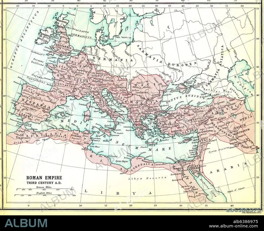
Europa / Landkarten:-"Roman Empire third century A.D.".-(Das Römische Reich im 3.Jh. n.Chr.) Aus: Atlas of the Historical Geography of the Holy Land. Designed and edited by George Adam Smith and prepared unter the direction of J.G. Bartholomew. London, Hodder and Stroughton, 1915.
Obra:
ATLAS OF THE HISTORICAL GEOGRAPHY OF THE HOLY LA
Fecha obra:
1915
Fecha evento:
250
Crédito:
Album / akg-images
Autorizaciones:
Modelo: No - Propiedad: No
¿Preguntas relacionadas con los derechos?
¿Preguntas relacionadas con los derechos?
Tamaño imagen:
2463 x 2007 px | 14.1 MB
Tamaño impresión:
20.9 x 17.0 cm | 8.2 x 6.7 in (300 dpi)
Palabras clave:
ANTIGÜEDAD • ANTIGÜEDADES • ANTIQUITY • ATLAS OF THE HISTORICAL GEOGRAPHY OF THE HOLY LA • ATLAS • AÑOS 1910 • BARTHOLOMEW, J. G. • CARTOGRAFIA • COMUNES • EUROPA (GEOGRAFIA) • EUROPA • GEOGRAFIA • IMPERIO ROMANO • MAPA • MEDITERRANEO • ROMA IMPERIAL • S. XX • SIGLO III • SIGLO XX • SMITH, GEORGE ADAM • TOPOGRAFIA
