alb4061296
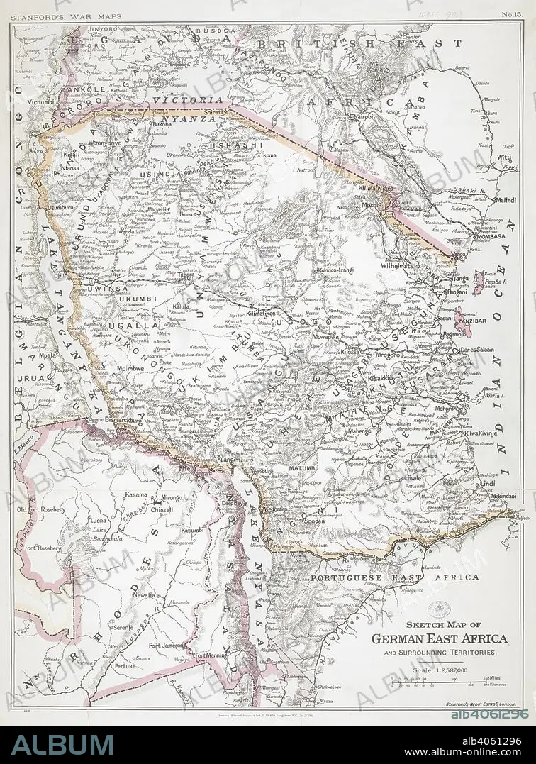
First World War sketch map of German East Africa, 1916. Stanford's War Maps. No. 14. Sketch map of German East Africa and surrounding territories. Scale, 1 : 2,587,000. 27 January 1916. Source: Maps.1035.(90) no.15.
| Compartir |
|---|
 Pinterest Pinterest |
 Twitter Twitter |
 Facebook Facebook |
 Copiar enlace Copiar enlace |
 Email Email |
|
Añadir a otro lightbox |
|
Añadir a otro lightbox |


¿Ya tienes cuenta? Iniciar sesión
¿No tienes cuenta? Regístrate
Compra esta imagen.
Selecciona el uso:

Descripción: Ver traducción automática
First World War sketch map of German East Africa, 1916. Stanford's War Maps. No. 14. Sketch map of German East Africa and surrounding territories. Scale, 1 : 2,587,000. 27 January 1916. Source: Maps.1035.(90) no.15.
First World War sketch map of German East Africa, 1916. Stanford's War Maps. No. 14. Sketch map of German East Africa and surrounding territories. Scale, 1 : 2,587,000. 27 January 1916. Source: Maps.1035.(90) no.15.
Crédito: Album / British Library
Autorizaciones: ? Cesión de modelo: No - ? Cesión de propiedad: No
¿Preguntas relacionadas con los derechos?
¿Preguntas relacionadas con los derechos?
Tamaño imagen: 6008 × 8136 px | 139.8 MB
Tamaño impresión: 50.9 × 68.9 cm | 2365.4 × 3203.1 in (300 dpi)
Palabras clave: 1ª GUERRA MUNDIAL • ACONTECIMIENTO • AFRICA ORIENTAL • AFRICA • CARTOGRAFIA • CARTOGRAFICO • COMBATE • CONFLICTO ARMADO • CONFLICTO BELICO • CONFLICTOS ARMADOS • ESTE DE AFRICA • EVENTO MILITAR • EVENTOS MILITARES • GRAFICO • GRAN GUERRA • GUERRA MUNDIAL I 1914/18 • GUERRA MUNDIAL I • GUERRA MUNDIAL • GUERRA • GUERRAS • MAPA • MAPAS • PRIMERA GUERRA MUNDIAL 1914/18 • PRIMERA GUERRA MUNDIAL • S. XX • SIGLO XX • WAR • WW1
