alb4190452
Map of the Waterloo campaign, 1815, Walmer Castle, Kent. Artist: Unknown.
| Compartir |
|---|
 Pinterest Pinterest |
 Twitter Twitter |
 Facebook Facebook |
 Copiar enlace Copiar enlace |
 Email Email |
|
Añadir a otro lightbox |
|
Añadir a otro lightbox |


¿Ya tienes cuenta? Iniciar sesión
¿No tienes cuenta? Regístrate
Compra esta imagen.
Selecciona el uso:

Título: Map of the Waterloo campaign, 1815, Walmer Castle, Kent. Artist: Unknown.
Descripción: Ver traducción automática
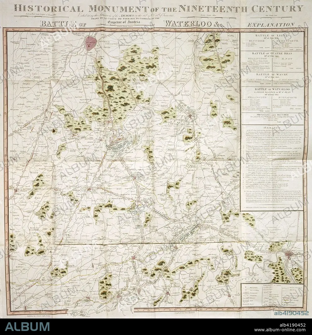
Map of the Waterloo campaign, 1815, Walmer Castle, Kent. Map Exhibiting the Situation of the Armies on the 16, 17 & 18 of June 1815. The Battle of Ligny, Quatre Bras, Waterloo and Wavre.
Map of the Waterloo campaign, 1815, Walmer Castle, Kent. Map Exhibiting the Situation of the Armies on the 16, 17 & 18 of June 1815. The Battle of Ligny, Quatre Bras, Waterloo and Wavre.
Crédito: Album / Heritage Images / Historic England Archive
Autorizaciones: ? Cesión de modelo: No - ? Cesión de propiedad: No
¿Preguntas relacionadas con los derechos?
¿Preguntas relacionadas con los derechos?
Tamaño imagen: 3623 × 3691 px | 38.3 MB
Tamaño impresión: 30.7 × 31.3 cm | 1426.4 × 1453.1 in (300 dpi)
Palabras clave: ARTHUR WELLESLEY • ARTHUR • BATALLA DE WATERLOO • BATALLA • BELGICA • BONAPARTE • BRITANICO • CAMPANA • CASTILLO • COLOR • COLORIDO • CONCEPTO • CONFLICTO BELICO • DUQUE DE WELLINGTON • EDIFICIO • EDIFICIOS • EJERCITO • FORTIFICACION • FRANCES • FRANCIA • GRAN BRETAÑA • GUERRA NAPOLEONICA • GUERRA • GUERRAS NAPOLEONICAS • GUERRAS • MAPA • MILITAR • PAÍS • PRUSIA • PRUSIANO • SIGLO XIX • SIGLO • WAR
