alb9507328
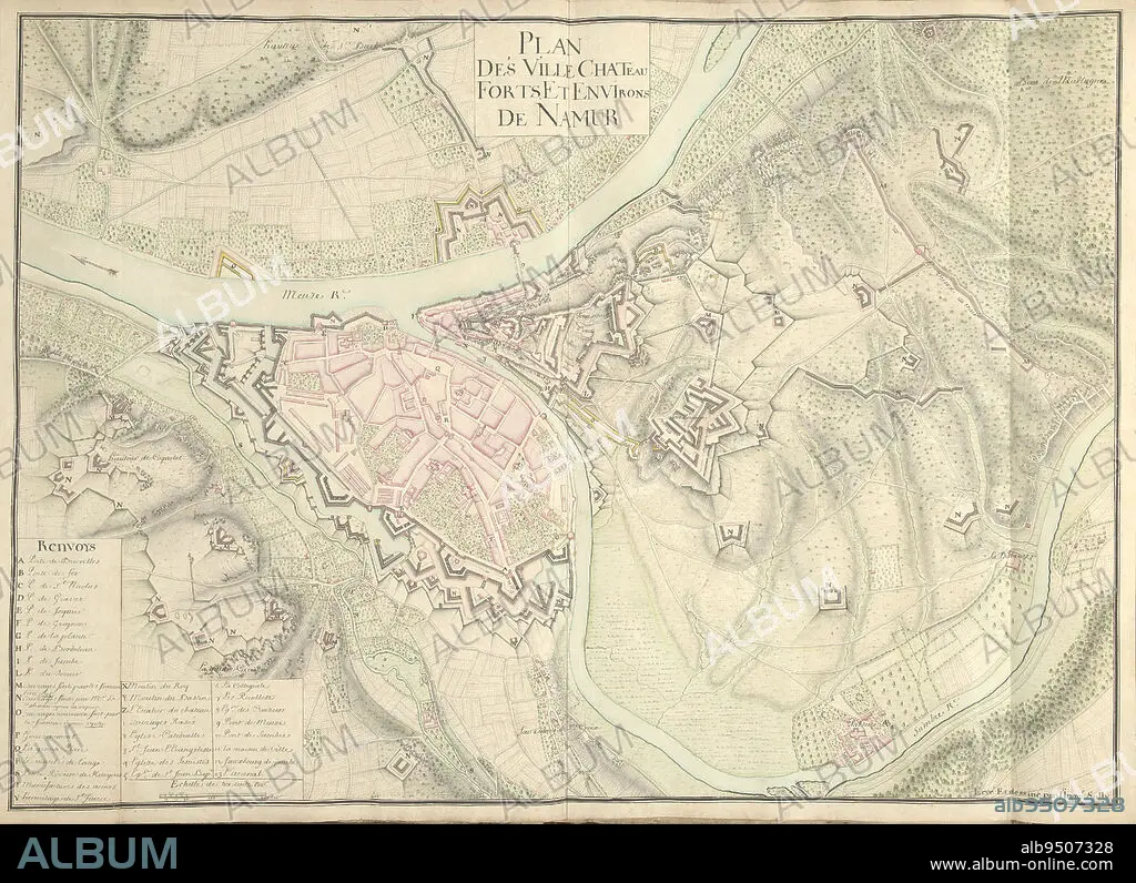
Map of Namur, ca. 1701-1715, Nicolas Suly, 1701 - 1715, Map of the fortifications around the city of Namur with the castle, ca. 1701-1715. Bottom left legend A-Z and 1-13 in French. Part of a collection of drawn plans of fortified towns in the Netherlands and surrounding countries at the time of the War of the Spanish Succession (part B)., draughtsman: Nicolas Suly, (mentioned on object), Netherlands, 1701 - 1715, paper, h 530 mm × w 730 mm.
| Compartir |
|---|
 Pinterest Pinterest |
 Twitter Twitter |
 Facebook Facebook |
 Copiar enlace Copiar enlace |
 Email Email |
|
Añadir a otro lightbox |
|
Añadir a otro lightbox |


¿Ya tienes cuenta? Iniciar sesión
¿No tienes cuenta? Regístrate
Compra esta imagen.
Selecciona el uso:

Descripción:
Ver traducción automática
Map of Namur, ca. 1701-1715, Nicolas Suly, 1701 - 1715, Map of the fortifications around the city of Namur with the castle, ca. 1701-1715. Bottom left legend A-Z and 1-13 in French. Part of a collection of drawn plans of fortified towns in the Netherlands and surrounding countries at the time of the War of the Spanish Succession (part B)., draughtsman: Nicolas Suly, (mentioned on object), Netherlands, 1701 - 1715, paper, h 530 mm × w 730 mm
Crédito:
Album / quintlox
Autorizaciones:
Modelo: No - Propiedad: No
¿Preguntas relacionadas con los derechos?
¿Preguntas relacionadas con los derechos?
Tamaño imagen:
6086 x 4418 px | 76.9 MB
Tamaño impresión:
51.5 x 37.4 cm | 20.3 x 14.7 in (300 dpi)
