alb1642906
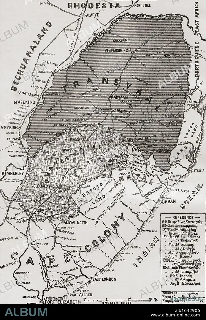
Map of The Boer Republics at the end of the 19th century. From the book South Africa and the Transvaal War, Volume 1 by Louis Creswicke, published 1900.
| Compartir |
|---|
 Pinterest Pinterest |
 Twitter Twitter |
 Facebook Facebook |
 Copiar enlace Copiar enlace |
 Email Email |
|
Añadir a otro lightbox |
|
Añadir a otro lightbox |


¿Ya tienes cuenta? Iniciar sesión
¿No tienes cuenta? Regístrate
Compra esta imagen.
Selecciona el uso:

Descripción:
Ver traducción automática
Map of The Boer Republics at the end of the 19th century. From the book South Africa and the Transvaal War, Volume 1 by Louis Creswicke, published 1900.
Crédito:
Album / Universal History Archive/Universal Images Group
Autorizaciones:
Tamaño imagen:
3627 x 5350 px | 55.5 MB
Tamaño impresión:
30.7 x 45.3 cm | 12.1 x 17.8 in (300 dpi)
