alb5479552
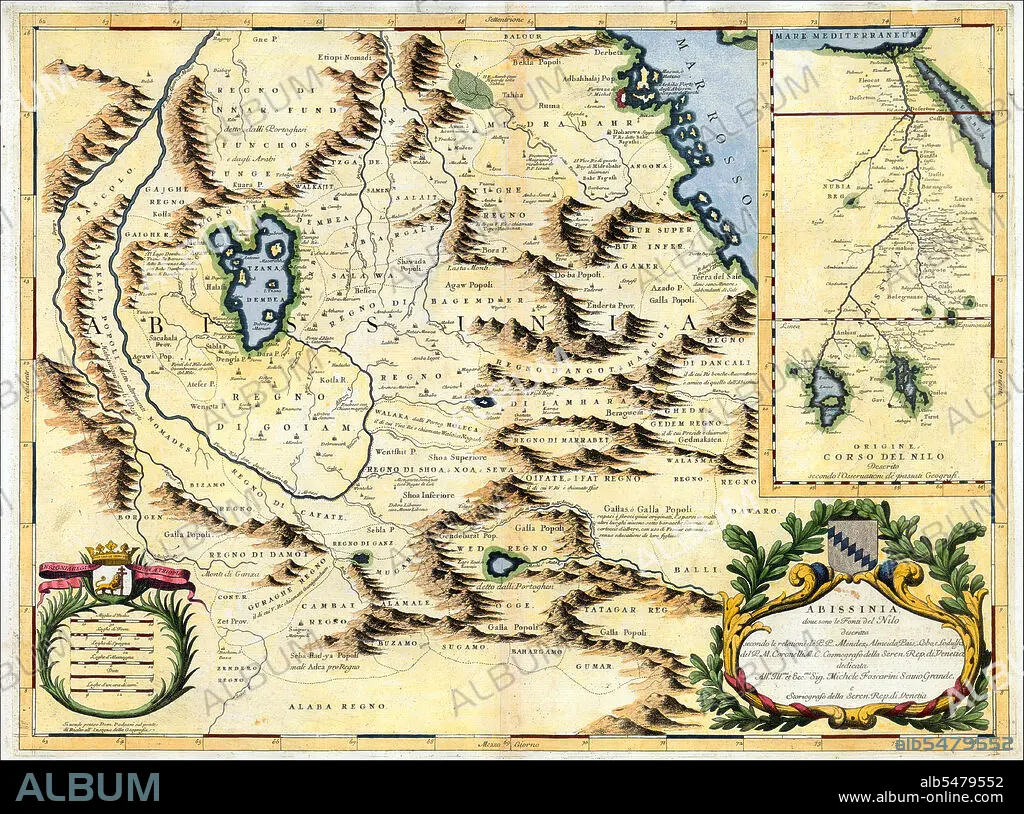
Northeast Africa: Map of the Nile from its source in Abyssinia to the Mediterranean, Vincenzo Coronelli (1690)
| Compartir |
|---|
 Pinterest Pinterest |
 Twitter Twitter |
 Facebook Facebook |
 Copiar enlace Copiar enlace |
 Email Email |
|
Añadir a otro lightbox |
|
Añadir a otro lightbox |


¿Ya tienes cuenta? Iniciar sesión
¿No tienes cuenta? Regístrate
Compra esta imagen

Título:
Northeast Africa: Map of the Nile from its source in Abyssinia to the Mediterranean, Vincenzo Coronelli (1690)
Descripción:
Ver traducción automática
A Venetian cartographer, Coronelli (1650-1718) cites his sources for this Nile map, including the Portuguese Jesuits Pedro Páez and Jerónimo Lobo, and contrasts his work with an inset showing the “original” (that is, outdated) course of the Nile as presented by past geographers, who followed the Ptolemaic tradition of two source lakes. Páez and Lobo had visited Ethiopia in the early 1600s, and both gave accounts of having seen the springs that natives believed to be the river’s source, though the Jesuits failed to distinguish between the two branches of the river. Coronelli’s Nile is the Blue Nile, and his geography is fairly accurate for that branch, identifying the significance of Lake Tsana and the clockwise unfolding of the river as it descends from there.
Crédito:
Album / Pictures From History/Universal Images Group
Autorizaciones:
Modelo: No - Propiedad: No
¿Preguntas relacionadas con los derechos?
¿Preguntas relacionadas con los derechos?
Tamaño imagen:
4807 x 3573 px | 49.1 MB
Tamaño impresión:
40.7 x 30.3 cm | 16.0 x 11.9 in (300 dpi)
