alb4552031
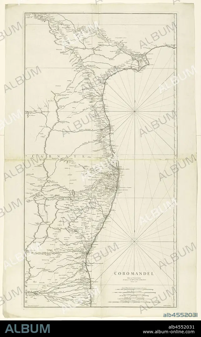
Map of Coromandel, Coromandel / par le Sr d'Anville (title on object), Map of the coast of Coromandel from mo Nega-Patnam to r.b. Narsapur, l.o. scale in French miles, nautical miles, regular Coss, large Coss and miles from Malabar. (Coss is an Indian length measure), maps of separate countries or regions, Coromandel coast, Jean Baptiste Bourguignon d'Anville (mentioned on object), Paris, Jan-1753, paper, engraving, h 960 mm × w 500 mm.
| Compartir |
|---|
 Pinterest Pinterest |
 Twitter Twitter |
 Facebook Facebook |
 Copiar enlace Copiar enlace |
 Email Email |
|
Añadir a otro lightbox |
|
Añadir a otro lightbox |


¿Ya tienes cuenta? Iniciar sesión
¿No tienes cuenta? Regístrate
Compra esta imagen.
Selecciona el uso:

Descripción:
Ver traducción automática
Map of Coromandel, Coromandel / par le Sr d'Anville (title on object), Map of the coast of Coromandel from mo Nega-Patnam to r.b. Narsapur, l.o. scale in French miles, nautical miles, regular Coss, large Coss and miles from Malabar. (Coss is an Indian length measure), maps of separate countries or regions, Coromandel coast, Jean Baptiste Bourguignon d'Anville (mentioned on object), Paris, Jan-1753, paper, engraving, h 960 mm × w 500 mm
Crédito:
Album / quintlox
Autorizaciones:
Modelo: No - Propiedad: No
¿Preguntas relacionadas con los derechos?
¿Preguntas relacionadas con los derechos?
Tamaño imagen:
3765 x 6000 px | 64.6 MB
Tamaño impresión:
31.9 x 50.8 cm | 12.6 x 20.0 in (300 dpi)
Palabras clave:
AGUAFUERTE • COSTA • ENGRAVING • ESCALA • GRABADO • GRABADOS • MALABAR (REGION) • MAPA • MILLA MARITIMA • OBJETO • PAPEL • PARIS • REGIONES
