alb3836471
Lau Basin Volcanic Region, Bathymetric Map
| Compartir |
|---|
 Pinterest Pinterest |
 Twitter Twitter |
 Facebook Facebook |
 Copiar enlace Copiar enlace |
 Email Email |
|
Añadir a otro lightbox |
|
Añadir a otro lightbox |


¿Ya tienes cuenta? Iniciar sesión
¿No tienes cuenta? Regístrate
Compra esta imagen.
Selecciona el uso:

Título:
Lau Basin Volcanic Region, Bathymetric Map
Descripción:
Ver traducción automática
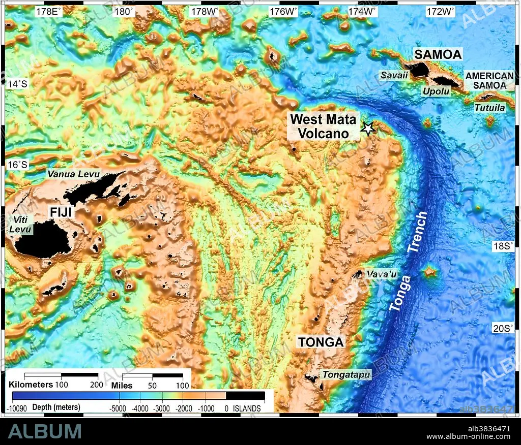
The Lau Basin is located in the southwest Pacific, within an area bounded by Samoa, Tonga and Fiji (the black areas on the map, which are the only areas above water). The area is home to many submarine volcanoes, such as West Mata.
Crédito:
Album / NOAA/Science Source
Autorizaciones:
Tamaño imagen:
5512 x 4428 px | 69.8 MB
Tamaño impresión:
46.7 x 37.5 cm | 18.4 x 14.8 in (300 dpi)
Palabras clave:
AGUA • ASIGNACIÓN • FIJI • FLOTA • FUENTE HIDROTERMAL • MAPA BATIMÉTRICO • MAPA • MAR • MARINA • MARINE • OCEANO PACIFICO • OCEANO • PROFUNDA • RESPIRADERO • SEA • SUBMARINO • TONGA • TOPOGRAFIA • TOPOGRÁFICOS • VOLCAN
