alb9617258
WENCESLAUS HOLLAR. Map of the British Isles and illustrations of 17th century historical events, c1659. Artist: Wenceslaus Hollar.
| Compartir |
|---|
 Pinterest Pinterest |
 Twitter Twitter |
 Facebook Facebook |
 Copiar enlace Copiar enlace |
 Email Email |
|
Añadir a otro lightbox |
|
Añadir a otro lightbox |


¿Ya tienes cuenta? Iniciar sesión
¿No tienes cuenta? Regístrate
Compra esta imagen.
Selecciona el uso:

Autor:
Título:
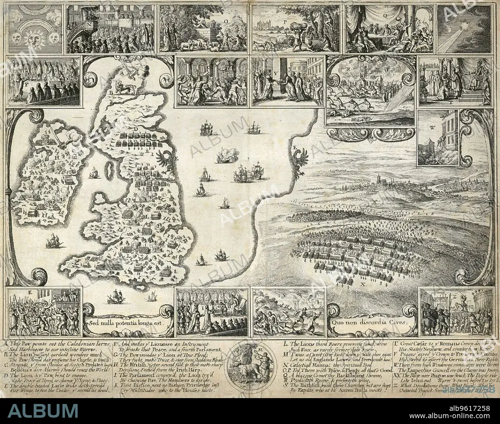
Map of the British Isles and illustrations of 17th century historical events, c1659. Artist: Wenceslaus Hollar.
Descripción:
Ver traducción automática
Map of the British Isles and illustrations of 17th century historical events, c1659. The large scene depicts the Battle of the White Mountain in Bohemia in 1620 in the the early stages of the Thirty Years War. The smaller compare the events of the English and Bohemian civil wars. From the Mayson Beeton Collection.
Personas:
Técnica/material:
engraving
Crédito:
Album / Historic England Archive/Heritage Images
Autorizaciones:
Modelo: No - Propiedad: No
¿Preguntas relacionadas con los derechos?
¿Preguntas relacionadas con los derechos?
Tamaño imagen:
4686 x 3731 px | 50.0 MB
Tamaño impresión:
39.7 x 31.6 cm | 15.6 x 12.4 in (300 dpi)
Palabras clave:
BATALLA • BLANCO Y NEGRO • CAMPO DE BATALLA • CHEQUIA • CONCEPTO • CONFLICTO BELICO • EJERCITO • GRABADO • GRAN BRETAÑA • GUERRA CIVIL INGLESA • GUERRA CIVIL • GUERRA DE LOS TREINTA AÑOS • GUERRA • HOLLAR • ISLAS BRITANICAS • MAPA • MILITAR • MONOCHROME • MONOCROMO • PRAGA • REPUBILCA CHECA • REPUBLICA CHECA • SIGLO XVII • SIGLO • SOLDADO • SOLDADOS • WAR • WENCESLAUS HOLLAR
