alb3932247
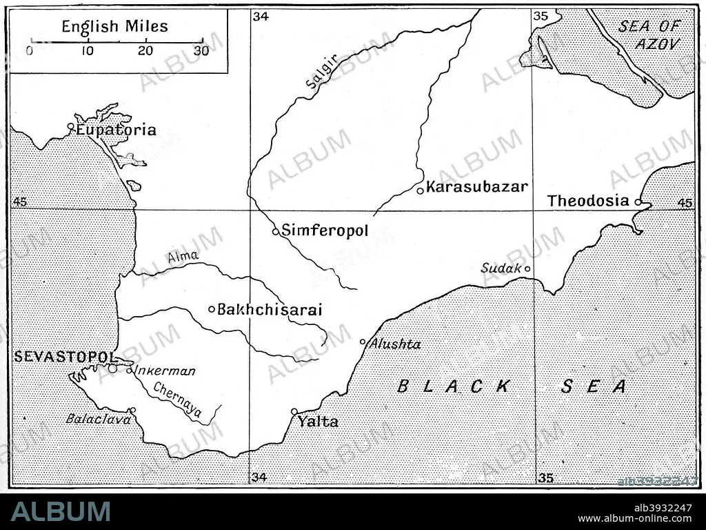
Map of the area where the Crimean War was fought in the 1850s, (c1920). Artist: Walter Hutchinson
| Compartir |
|---|
 Pinterest Pinterest |
 Twitter Twitter |
 Facebook Facebook |
 Copiar enlace Copiar enlace |
 Email Email |
|
Añadir a otro lightbox |
|
Añadir a otro lightbox |


¿Ya tienes cuenta? Iniciar sesión
¿No tienes cuenta? Regístrate
Compra esta imagen

Título:
Map of the area where the Crimean War was fought in the 1850s, (c1920). Artist: Walter Hutchinson
Descripción:
Ver traducción automática
Map of the area where the Crimean War was fought in the 1850s, (c1920). The plan shows the relative positions of the battlefields of Crimea. Illustration from Story of the British Nation, Volume IV, by Walter Hutchinson, (London, c1920s).
Crédito:
Album / The Print Collector / Heritage Images
Autorizaciones:
Modelo: No - Propiedad: No
¿Preguntas relacionadas con los derechos?
¿Preguntas relacionadas con los derechos?
Tamaño imagen:
4080 x 2848 px | 33.2 MB
Tamaño impresión:
34.5 x 24.1 cm | 13.6 x 9.5 in (300 dpi)
Palabras clave:
BLANCO Y NEGRO • CONCEPTO • EPOCA VICTORIANA • GEOGRAFIA • GUERRA • MAR NEGRO • MAR • MONOCHROME • MONOCROMO • PASAMONTAÑAS • SEBASTOPOL • SIGLO XIX • SIGLO • UCRANIA • VICTORIANO • WALTER
