alb4057772
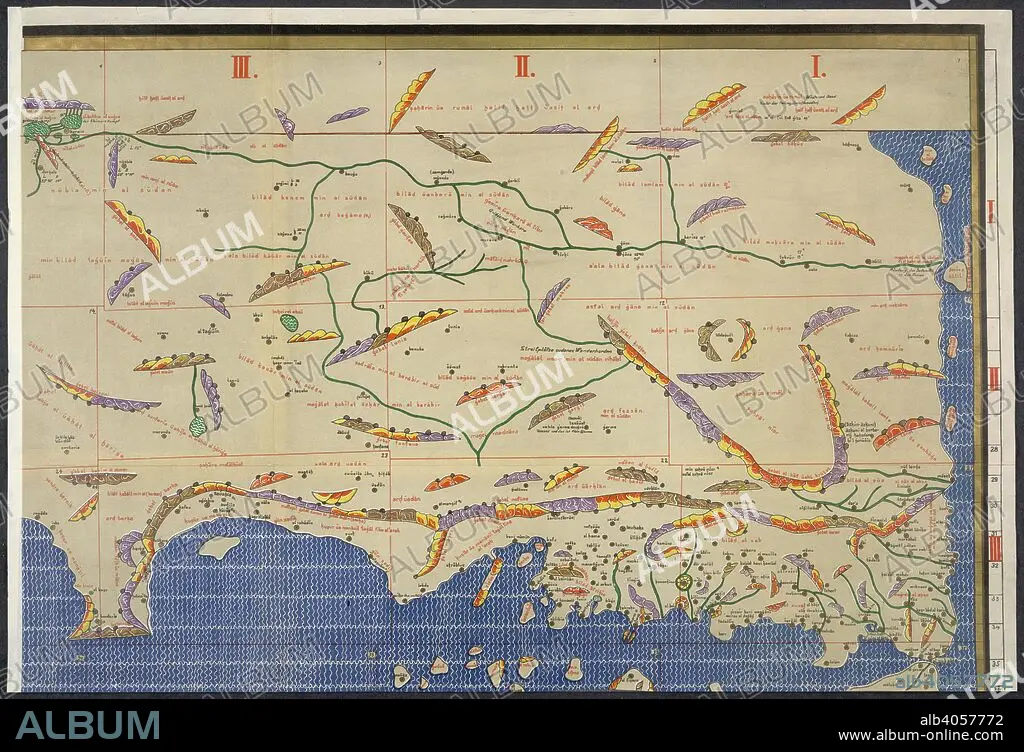
World map. Charta Rogeriana--Weltkarte des Idrisi--vom Jahr 1. Stuttgart, 1928. Section of Idrisi world map. Image taken from Charta Rogeriana--Weltkarte des Idrisi--vom Jahr 1154 n. Ch. Wiederhergestellt und herausgegeben von Konrad Miller. (Explanations. pp. 38)..6 Sh. 670 x 450 mm.. Originally published/produced in Stuttgart, 1928. . Source: Maps.856.(6), upper right.
| Compartir |
|---|
 Pinterest Pinterest |
 Twitter Twitter |
 Facebook Facebook |
 Copiar enlace Copiar enlace |
 Email Email |
|
Añadir a otro lightbox |
|
Añadir a otro lightbox |


¿Ya tienes cuenta? Iniciar sesión
¿No tienes cuenta? Regístrate
Compra esta imagen.
Selecciona el uso:

Descripción:
Ver traducción automática
World map. Charta Rogeriana--Weltkarte des Idrisi--vom Jahr 1. Stuttgart, 1928. Section of Idrisi world map. Image taken from Charta Rogeriana--Weltkarte des Idrisi--vom Jahr 1154 n. Ch. Wiederhergestellt und herausgegeben von Konrad Miller. (Explanations. pp. 38)..6 Sh. 670 x 450 mm.. Originally published/produced in Stuttgart, 1928. . Source: Maps.856.(6), upper right.
Crédito:
Album / British Library
Autorizaciones:
Tamaño imagen:
6132 x 4185 px | 73.4 MB
Tamaño impresión:
51.9 x 35.4 cm | 20.4 x 13.9 in (300 dpi)
Palabras clave:
