alb9332496
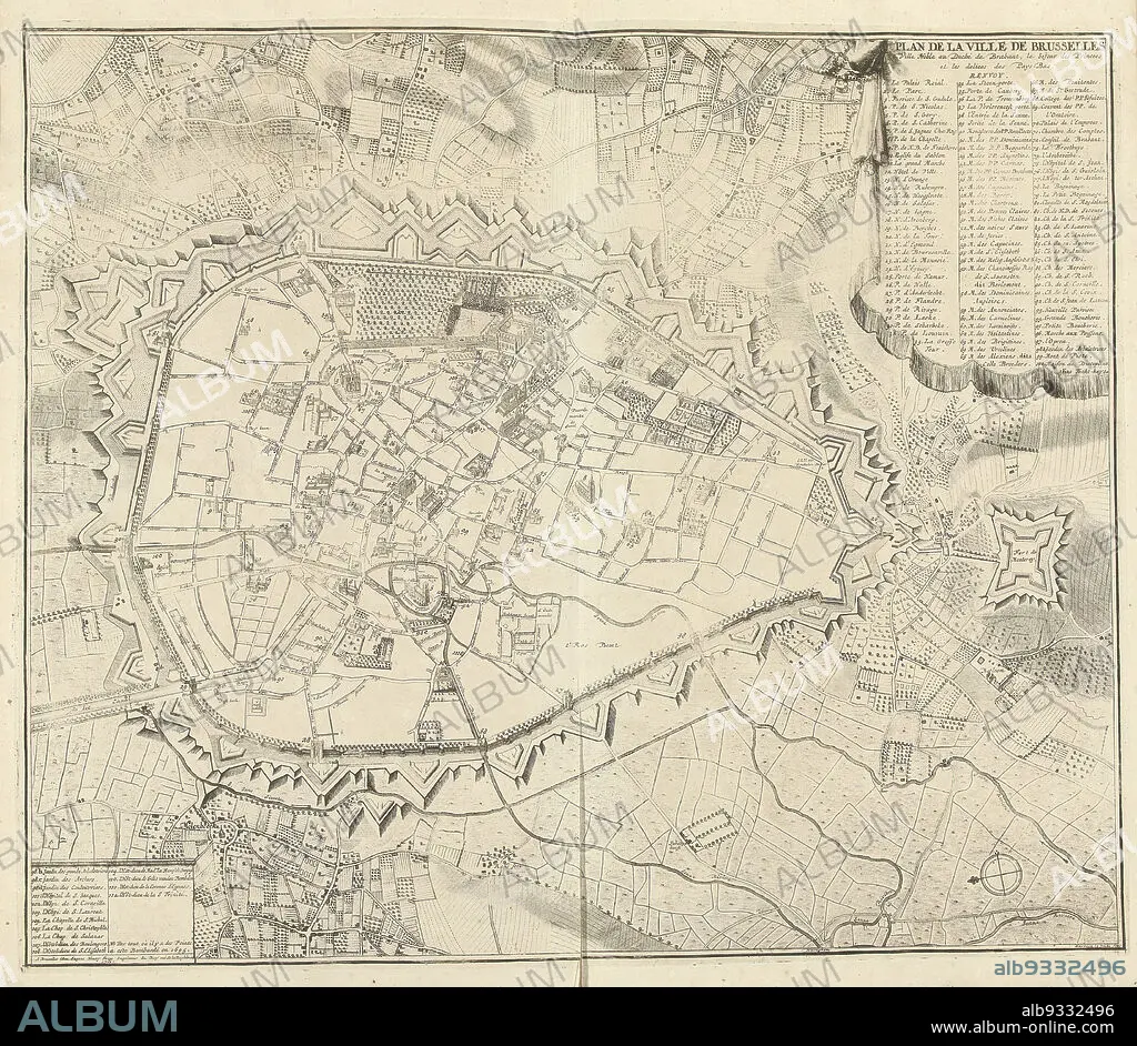
Map of Brussels, 1711, Plan de la ville de Brusseles (title on object), Map of Brussels, 1711. Top right legend 1-100, bottom left continuation 101-114. Part of a bundled collection of plans of battles and cities renowned in the War of the Spanish Succession., print maker: J.G. Harrewijn (II) (mentioned on object), publisher: Eugene Henry Fricx (mentioned on object), Brussels, 1711, paper, etching, engraving, height 510 mm × width 600 mm.
| Compartir |
|---|
 Pinterest Pinterest |
 Twitter Twitter |
 Facebook Facebook |
 Copiar enlace Copiar enlace |
 Email Email |
|
Añadir a otro lightbox |
|
Añadir a otro lightbox |


¿Ya tienes cuenta? Iniciar sesión
¿No tienes cuenta? Regístrate
Compra esta imagen.
Selecciona el uso:

Descripción:
Ver traducción automática
Map of Brussels, 1711, Plan de la ville de Brusseles (title on object), Map of Brussels, 1711. Top right legend 1-100, bottom left continuation 101-114. Part of a bundled collection of plans of battles and cities renowned in the War of the Spanish Succession., print maker: J.G. Harrewijn (II) (mentioned on object), publisher: Eugene Henry Fricx (mentioned on object), Brussels, 1711, paper, etching, engraving, height 510 mm × width 600 mm
Crédito:
Album / quintlox
Autorizaciones:
Tamaño imagen:
4912 x 4266 px | 60.0 MB
Tamaño impresión:
41.6 x 36.1 cm | 16.4 x 14.2 in (300 dpi)
